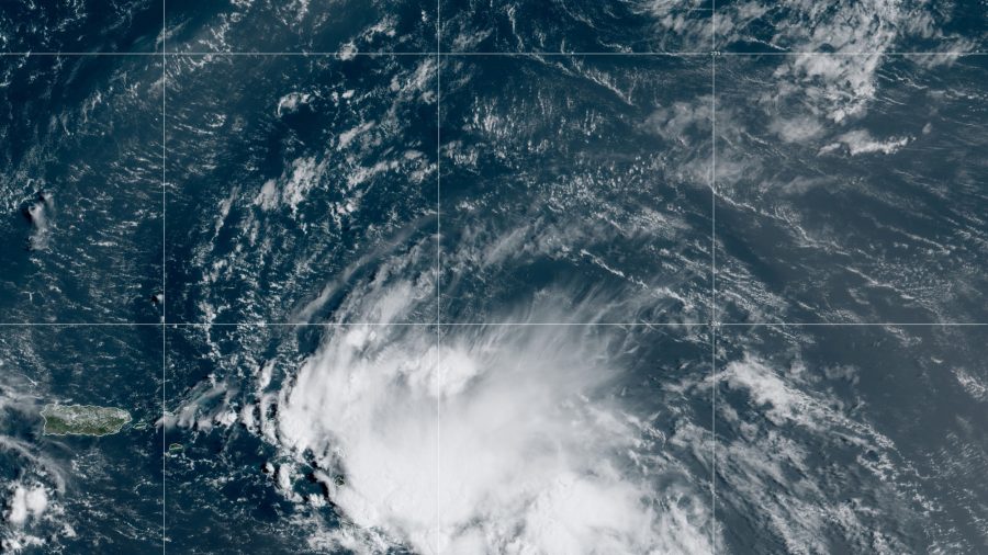
MEXICO CITY—Tropical Storm Laura formed Friday in the eastern Caribbean and forecasters said it poses a potential hurricane threat to Florida and the U.S. Gulf Coast. A second storm also might hit the U.S. as a hurricane after running across Mexico’s Yucatan Peninsula.
The new tropical storm was centered about 210 miles (335 kilometers) east-southeast of the northern Leeward Islands Friday morning, with maximum sustained winds of 45 mph (75 kph). It was heading west at 18 mph (30 kph), according to the U.S. National Hurricane Center.
The forecast track shows the storm likely to skirt or hit Puerto Rico, the Dominican Republic, Haiti, and Cuba en route to a Wednesday collision with the U.S. Gulf Coast as a hurricane, though both the force and track were still uncertain.
It was expected to dump heavy rains along the way, causing threats of flooding.
Meanwhile, Tropical Depression 14 was veering to the northwest after nearing the Honduran coast and forecasters said they expected it to gain force before hitting the tip of Mexico’s Yucatan Peninsula Saturday night, possibly at or near hurricane force. A hurricane watch was in effect for the strip of coast containing Tulum, Playa del Carmen, and Cancun, as well as Cozumel island.
From there, the long-term forecast track would carry it to the U.S. Gulf Coast, perhaps Texas or Louisiana, by Tuesday or Wednesday. Forecasters said it was likely to reach hurricane force over the Gulf of Mexico, but slip back to tropical storm force before reaching the United States, though the outlook was uncertain.
En route, it’s likely to soak flood-prone eastern Honduras, the Cayman Islands, and parts of the Yucatan.
On Friday morning, it was centered about 165 miles (270 kilometers) east of the Honduran resort island of Roatan, with 35 mph (55 kph) winds. It was headed northwest at 14mph (22 kph).
In the Pacific, former Category 4 Hurricane Genevieve was weakening and heading further out to sea after a glancing blow to the southern tip of the Baja California Peninsula, where it caused at least two deaths and knocked out power to a large part of the Los Cabos area.
The Hurricane Center said Tropical Storm Genevieve had maximum sustained winds of 45 mph (75 kph) and was centered about 155 miles (255 kilometers) west of Cabo San Lazaro, Mexico.
It was heading west-northwest at 10 mph (17 kph).


