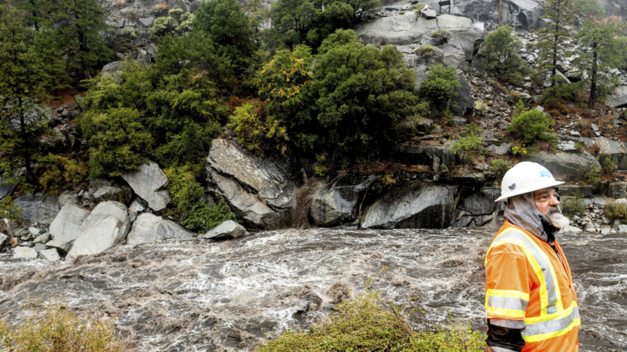
It’s time to stay weather aware as a barrage of threats unfolds across the United States this week, creating hazards from coast to coast.
From “bomb cyclones” to severe weather and nor’easters, this week has it all.
Evacuation Orders in Place Across Some California Burn Scar Areas
As a “bomb cyclone” ramps up a firehouse of heavy rain across the West, new evacuation orders have been issued for vulnerable locations near recent burn scars.
Santa Barbara County officials upgraded the recent evacuation warning to an evacuation order for parts of the Alisal Fire burn area. Concerns are mounting about dangerous debris flows to develop as heavy rain is forecast to fall over the recently scorched earth.
Evacuation orders mean that it is unlawful to remain in place, with an immediate threat to life and property.
The threats associated with this atmospheric river don’t stop there. Several feet of snow are forecast for the Sierra Nevada mountain range creating nearly impossible driving conditions, according to the National Weather Service (NWS) office in Hanford, California.
Expect major travel delays as chain controls and roadway closures are likely to be enforced. The most intense snowfall will occur Sunday night into Monday and will be heaviest at elevations above 5,000 feet.
Strong winds gusting over 50 miles per hour will accompany the heavy, wet snow.
The NWS has flash flood watches across a large expanse of central and northern California. Rainfall accumulations of 3 to 6 inches, with locally higher amounts exceeding 10 inches, will lead to localized flash flooding, mudslides and rockslides.
Particularly vulnerable roadways and streams are most at risk with this event, as the heavy rain is forecast to last into Monday.
Significant Tornado Outbreak Possible Sunday
Severe weather is possible early this week for a large part of the country.
A temperature battleground is setting the stage for an outbreak that will begin Sunday across the mid Mississippi Valley and move east to the Carolinas and mid-Atlantic states by Monday.
Tornadoes, large hail and damaging winds are all possible Sunday across parts of Arkansas, Missouri, Illinois and Indiana.
However, the Storm Prediction Center has highlighted a specific area from St. Louis to Springfield, Missouri, as having a significant threat for tornadoes. This region has a greater than 10% probability of a strong tornado (EF-2 to EF-5) within 25 miles of any particular point.
Fall is commonly considered a secondary peak season for severe weather in the US.
Large temperature swings associated with the changing seasons can help fuel severe weather development. Even though tornadoes can occur anytime of the year, fall typically experiences an uptick in activity as warm, humid air from the south interacts with increasingly more potent cold fronts from the north.
Weather Models Hint at Possible Nor’easter Midweek
The same energy associated with the severe weather outbreak will translate to a powerful low pressure system known as a nor’easter along the East Coast of the US by Tuesday and Wednesday.
Conditions are looking favorable for strong northeasterly winds to develop, which is how a nor’easter gets its name. Coastal flooding and heavy rain are also possible across southern New England.
Specific forecast details are still unknown, as this event is still several days away, but the potential exists for urban and street flooding. Some computer models predict more than 6 inches of rain for the region.
As the autumn leaves are still yet to fall across much of New England, gusty winds could easily topple trees and branches. This may potentially lead to power outages across the region.


