


Atmospheric rivers have been lashing the Pacific Northwest of the United States, prompting winter storm warnings for 11 states, with more heavy rain, snow, and strong winds predicted to follow in the coming days.
An atmospheric river is a narrow space in the atmosphere that transports significant amounts of water vapor. When they hit land, the vapor is released through rain, snow, or a combination of both. According to the National Oceanic and Atmospheric Administration, atmospheric rivers can vary significantly in size and strength. On average, they carry roughly the equivalent of the water flow through the mouth of the Mississippi River. More powerful ones can transport up to 15 times more water vapor.
AccuWeather meteorologists predict that from at least Sunday to Wednesday, locations across Washington, Oregon, Northwest California, northern Idaho, and western Montana could face even more wild weather due to an atmospheric river overhead. An additional 1–2 inches of rain in most affected regions is being forecast. Coastal areas are expected to be hit with far more rain; a further 4–8 inches is being predicted.
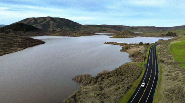
Regions from northwest California to western Washington have already reported flooded roadways, travel disruptions, along with rock and mudslides. Additional rainfall in those areas could worsen the conditions.
Flood watches and advisories are in place for numerous counties across western Washington and Oregon through to Wednesday night due to the steady stream of rainfall that will continue to spread inland.
A Dec. 4 report by AccuWeather Meteorologist, Alyssa Glenny, warns that the highest population centers of the Pacific Northwest, Seattle, Portland and Oregon, could potentially see the total a month’s rainfall in the first six days of December as the prolonged stretch of rain continues.
“As of Sunday evening, 1.25 inches has fallen in Seattle since the start of the month, while Portland has recorded 2.20 inches,” AccuWeather meteorologist Elizabeth Danco said.
“Both cities are expected to receive an additional 2-4 inches of rain through Wednesday, the historical average rainfall for the month of December is 5.72 inches in Seattle and 5.77 inches in Portland.”
AccuWeather Meteorologist Haley Taylor believes the heaviest rain will taper off by Wednesday, with a likely break in the lingering damp conditions by Thursday night.
“Looking ahead to later this week, a storm moving into the Northwest can bring colder air back into the region on Thursday, allowing for temperatures to drop closer to the historical average, however the stormy pattern should shut off,” she said.
“Mainly dry conditions are expected to continue on Friday, but another round of rain and mountain snow can sneak back into the Pacific Northwest by late Friday into Saturday.”
AccuWeather says there is a silver lining to the expected deluge though. While it might cause travel disruptions, road closures, and flooding, the persistent rainfall could gradually help improve the drought conditions.
According to the U.S. Drought Monitor, locations across western Oregon and Washington are enduring moderate to severe drought conditions. Cities such as Seattle have suffered from a relatively dry summer, setting the stage for the drought.
Avalanche Danger Increased Across Several Regions As Well

Snow levels in the northwest mountains are also expected to rise significantly before warmer conditions set in early this week. According to Ms. Taylor, this brings some risk of flooding as well.
“Rising temperatures through Wednesday can lead to snow melting, especially in the Cascades where over a foot of snow has fallen,” she said.
“The snowmelt, in addition to the heavy rain Monday and Tuesday, can lead to flooding concerns and dangerous travel, especially in the mountains and foothills.”
Heavy rain falling in the mountains amid rising temperatures could cause the snowpack on steep mountain slopes to become more unstable, increasing the risk of avalanches. The Northwest Avalanche Center has issued avalanche warnings for the slopes of the Washington Cascades, Mount Hood, Stevens Pass, and Snoqualmie Pass. All are facing a level four-high avalanche danger through to at least Sunday. Travel is not recommended until after the weekend, if at all.
California Drought Free After Multiple Atmospheric Rivers
Most of these areas are not strangers to massive rainfalls over a short period, especially during the winter months from November to January. California, in particular, has been grappling with atmospheric river floods all year. Starting in March, forecasters warned that most of California was facing another atmospheric river storm system that would likely produce heavy rain.
Again, a new series of atmospheric rivers flowed into California in September, prompting warnings of widespread heavy rain and flooding. The following months saw more than 9,000 people ordered to evacuate, and over 54,000 without power, as parts of California were struck with yet another atmospheric river system. Heavy rain, thunderstorms, and strong winds resulted in floods on several major highways and small rural communities in the southern and central regions of the state.
California had been dealing with a prolonged drought for nearly three years during a strong La Nina event. However, after a shift toward neutral and now El Nino conditions, the state has been declared officially drought-free and is expected to stay that way until at least the end of January 2024.
From The Epoch Times