A lobe of frigid air will sag deeply into the United States, bringing freezing temperatures as far south as Florida while severe thunderstorms roll up the Mid-Atlantic and heavy snow hits parts of the Northeast.
March started out quite mild in the Eastern U.S. and even downright warm in the Southeast. Many locations set record highs in the 70s and 80s as recently as last Sunday and Monday. The warmth has prompted many trees, flowers, and crops to begin blooming already.
But the intense storm will bring plummeting temperatures and frigid air from Canada all the way down to the Gulf Coast. Locations from Louisiana to South Carolina and southward into Florida are expecting a deep freeze Saturday night into Sunday morning. Many of these locations will experience a hard freeze, with several hours below 28 degrees.
Low temperatures in the low to mid 20s and below freezing for a significant duration in much of the Deep South will threaten the vulnerable vegetation that already bloomed there.
“Freeze conditions will kill crops, other sensitive vegetation and possibly damage unprotected outdoor plumbing,” the National Weather Service in Birmingham, Alabama, said.
More than 25 million people in the South are under freeze warnings Saturday night into Sunday. Cities under the watch include New Orleans; Jackson, Mississippi; Birmingham, Alabama; Atlanta; and Tallahassee and Jacksonville in Florida.
Temperatures will be in the teens for the Tennessee Valley into the Mid-Atlantic and Northeast, but freeze warnings are not issued for these locations because the growing season has not begun.
Southeast and Mid-Atlantic Brace for Strong Winds and Severe Storms
Strong winds will hit parts of the Southeast and Mid-Atlantic—and strong thunderstorms are possible especially in the Mid-Atlantic—on Saturday as the system spins toward the Northeast. Some of these storms could create tornadoes.
Winds have interrupted electric service in parts of those regions. By 8 a.m. ET Saturday, more than 180,000 homes and businesses were without power in the South and Mid-Atlantic—with the majority in Georgia, North Carolina, Florida, Alabama and Virginia, according to PowerOutage.us.
There is an enhanced (Level 3 of 5) threat for severe storms from coastal North Carolina to Myrtle Beach, South Carolina, through midday Saturday, and a slight (Level 2) risk extends northward to Norfolk, Virginia, and southward into central Florida.
Periods of heavy rain, strong winds, and hail are possible, the NWS office in Charleston, South Carolina reported.
Tornadoes there are also possible on Saturday.
A tornado watch was scheduled to be in effect Saturday until 1 p.m. ET for portions of eastern North and South Carolina as well as southeastern Virginia. This includes the cities of Norfolk, Virginia; Hatteras and Wilmington in North Carolina; and Myrtle Beach, South Carolina. The main threats for this area include a couple of tornadoes and scattered damaging wind gusts, up to 75 mph.
An extended tornado watch also is in effect through 11 a.m. ET Saturday for 26 counties in Florida, covering the cities of Tampa, Daytona Beach, and Orlando. Nine counties in southeastern Georgia are also under that watch.
Bomb Cyclone Roars Across Eastern Seaboard
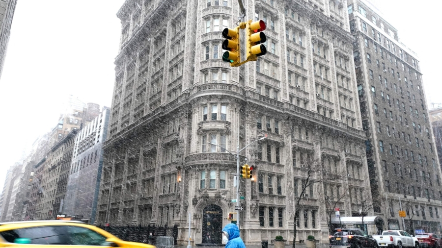
Farther north, the system is expected to strengthen into a bomb cyclone Saturday, bringing damaging winds and heavy snow, especially to parts of the interior Northeast, making travel treacherous.
A bomb cyclone forms when a storm decreases in pressure by 24 millibars (a measurement of pressure) in under 24 hours.
Generally, about 4 to 8 inches of snow are forecast from the southern Appalachians to New England. However, areas of high elevation in the interior Northeast could see up to a foot of snow through Sunday morning.
A blizzard warning is also in effect until mid-afternoon Saturday for portions of northern Virginia across the Blue Ridge.
Metropolitan areas along the coast, including Washington, DC, Philadelphia, New York and Boston are expected to collect rain and then some snow and sleet Saturday, though they will avoid the worst accumulations. Philadelphia may receive 2 to 4 inches of snow and sleet, with the other cities accumulating less, forecasters said.
More than 60 million people were under winter weather alerts from the weather service Saturday morning, stretching from Alabama to Maine.
New York state activated its Emergency Services’ Operations Center Friday night ahead of the impending storm.
“With up to a foot of snow forecast in some locations, this system is expected to create dangerous travel conditions throughout the next 36 hours, and New Yorkers should do their best to stay off the roads during this time,” Division of Homeland Security and Emergency Services Commissioner Jackie Bray said Friday in a news release.
The midsection of the country will see temperatures 30 degrees below average from Texas to Minnesota and single-digit wind chill factors across the Great Lakes and Northeast into the weekend.
Travel disruptions are expected for drivers and airline passengers alike. More than 950 flights within, into or out of the US have been canceled for Saturday, including more than 100 JetBlue flights, according to the tracking website FlightAware.


