
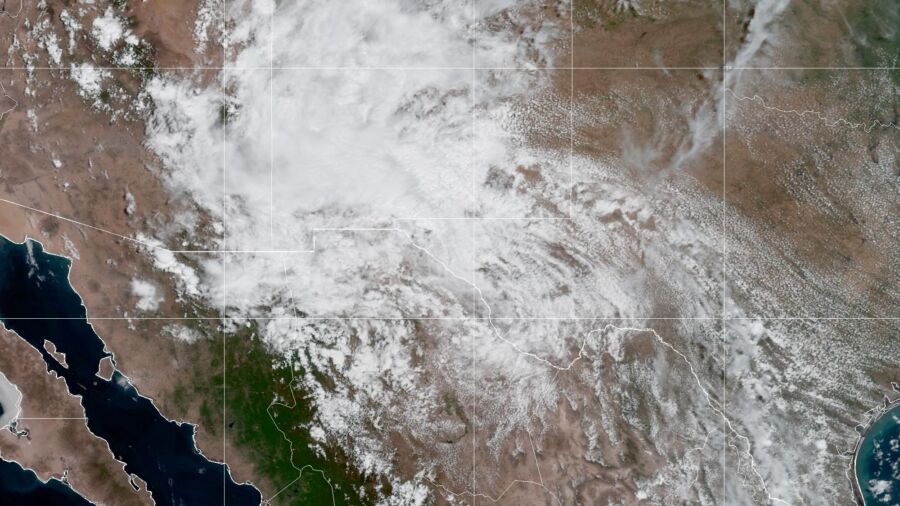
Tropical storm Harold made landfall in Texas on August 22, but soon weakened to a tropical depression. The storm is forecast, however, to bring heavy rain to the state through late Wednesday, Aug. 23.
Several counties had been issued with flood advisories on Tuesday evening, including Zavala, Maverick, and Dimmit counties. The National Weather Service for the Austin area reported around 4 inches of rain in the area.
The storm initially touched down on Padre Island on Tuesday morning, with maximum sustained winds of 50 mph.
"As the showers and thunderstorms continue to circle around the anchored upper high in the central U.S., the remnant tropical moisture is forecast to turn north and enter this part of the country from north-central Mexico, while also pushing into the central Great Basin on Friday.
"Thunderstorms will be capable of containing intense rainfall rates that could lead to rapid runoff and flooding concerns," the report said.
Texas Responds
Texas Gov. Greg Abbott issued orders on Aug. 21 to deploy state emergency response resources. The Texas State Emergency Operations Center was activated to "Escalated Response Conditions."Heat Alerts for 22 States
Meanwhile, the NWS reported that the searing August heat wave is forecast to continue through at least the end of this week, with oppressive heat from the central United States to the Gulf Coast."High temperatures throughout these areas are forecast to reach into the upper 90s and low 100s through Thursday before a cold front dropping south begins to usher in cooler temperatures over the Upper Midwest on Friday," the report said. "When factoring in brutal humidity levels, maximum heat indices could approach 120 degrees."
Heat alerts—which included Excessive Heat Warnings, Watches, and Advisories—have been issued from Minneapolis to New Orleans across an area that includes 22 states and roughly 130 million people, the NWS reported.