


NEW ORLEANS—The National Hurricane Center issued hurricane watches for parts of coastal Louisiana on Wednesday, July 10, as the first tropical system to slam the US this year is expected to make landfall as a hurricane.
The watches extend from the mouth of the Mississippi River west to Cameron, Louisiana. They do not include the New Orleans metro area, which was inundated with rain for several hours.
The National Hurricane Center predicts Tropical Storm Barry will form in the Gulf of Mexico by Thursday and strengthen to a hurricane by Saturday, when it’s expected to make landfall along the Louisiana or upper Texas coast. At least one Louisiana parish issued a mandatory evacuation ahead of the tropical storm.
Storm surge, hurricane force winds, and extensive flooding are forecast in the Gulf Coast region into the weekend.
The slow-moving storm was crawling at about 8 mph, the NHC said. That means it could hover over the same place for long time, dumping rain relentlessly.
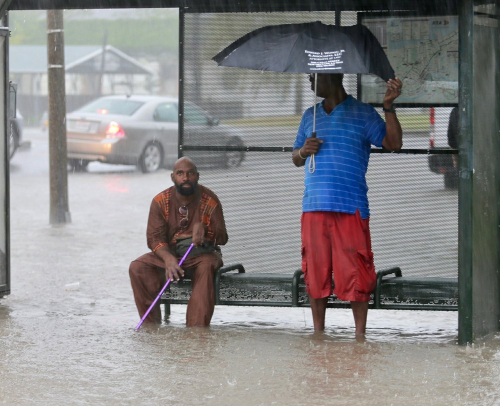
The tropical system spawned its first tornado warning and flash flood emergency, both in the New Orleans area, as streets and hotel lobbies flooded Wednesday.
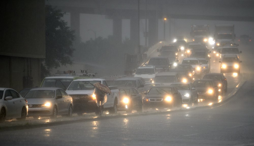
Lines of thunderstorms associated with the system ranged far out in into the Gulf and battered New Orleans, where as much as 7 inches (18 centimeters) of rain fell over a three-hour period Wednesday morning, forecasters said.
Mississippi and Texas were also at risk of torrential rains.
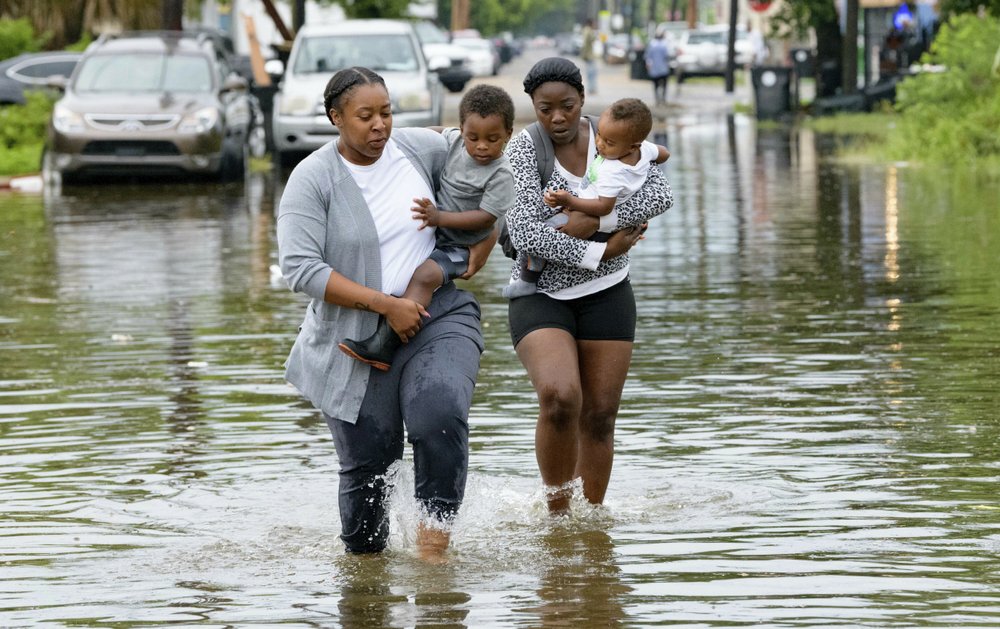
In New Orleans, streets turned into small, swift rivers that overturned garbage cans and picked up pieces of floating wood. Water was up to the doors of many cars. Other vehicles were abandoned. Kayakers paddled their way down some streets.
Chandris Rethmeyer lost her car to the flood and had to wade through water about 4 feet (1.22 meters) deep to get to safety. She was on her way home after working an overnight shift when she got stuck behind an accident in an underpass and the water started rising.

“I was going to sit in my car and let the storm pass,” she said. “But I reached back to get my son’s iPad and put my hand into a puddle of water.”
Valerie R. Burton woke up Wednesday to what looked like a lake outside her door.
“There was about 3 to 4 feet of water in the street, pouring onto the sidewalks and at my door. So I went to my neighbors to alert them and tell them to move their cars,” she said.
It was all a grim reminder of sudden flooding that surprised the city during an August 2017 rain. That flood exposed major problems at the agency overseeing street drainage. It led to personnel shake-ups at the New Orleans Sewerage and Water Board and required major repair efforts.
On Wednesday, the board said 118 of 120 drainage pumps were operational and the agency was fully staffed. But the agency’s director says that much rain in such a short time would have overwhelmed any drainage system.
Gov. John Bel Edwards declared a state of emergency and said National Guard troops and high-water vehicles would be positioned all over the state.
“The entire coast of Louisiana is at play in this storm,” Edwards said.
Forecasters said Louisiana could see up to 12 inches (30 centimeters) of rain by Monday, with isolated areas receiving as much as 18 inches (46 centimeters).
The heavy additional rain could push the already swollen Mississippi River precariously close to the tops of levees that protect New Orleans, officials said.
A spokesman for the Army Corps of Engineers in New Orleans said the agency was not expecting widespread overtopping of the levees, but there are concerns for areas south of the city. The river was expected to rise to 20 feet (6 meters) by late Friday at a key gauge in New Orleans. The area is protected by levees 20 to 25 feet (6 to 7.6 meters) high, he said.
The Corps was working with local officials to identify any low-lying areas and reinforce them, he said. He cautioned that the situation may change as more information about the storm arrives.
“We’re confident the levees themselves are in good shape. The big focus is height,” spokesman Ricky Boyett said.
The Mississippi River Could Crest at 19 Feet
Potential storm surge has prompted the National Weather Service to issue a flood warning for the Mississippi River, including at New Orleans, through Saturday.
The NWS said the river could crest at 19 feet, or 2.3 feet below the record. The city is protected to a height of 20 feet.
The Flood Protection Authority said it will be closing several flood gates and structures in the New Orleans area starting Wednesday.
“No one should take this storm lightly,” Gov. Edwards said.
By Chevel Johnson and Janet McConnaughey
The CNN Wire contributed to this report.