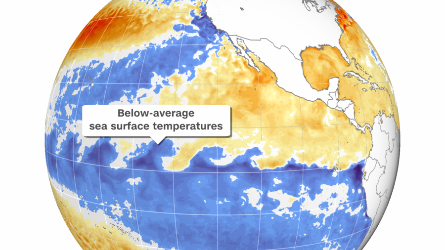
Winter weather, ongoing drought conditions, and even the remainder of hurricane season will see impacts from a recent cooling of sea surface temperatures in the Pacific.
La Niña conditions—the opposite phase of El Niño—have emerged in the tropical Pacific Ocean over the past month, the National Oceanic and Atmospheric Administration’s Climate Prediction Center said Thursday.
La Niña typically brings conditions that are wetter and cooler than average to the Pacific Northwest and northern Plains, especially during the winter.
In contrast, La Niña means drier and warmer-than-average conditions usually prevail in the South. This could mean the drought-stricken Southwest will likely stay dry. (La Niña also was present last winter and worsened the drought situation across the West and Southwest.)
The Southeast is also typically drier during a La Niña winter, though before the season starts, it increases the possibility for tropical weather, including hurricanes.
La Niña Will Persist Through Winter in the US
La Niña—translated from Spanish as “little girl”—is a natural ocean-atmospheric phenomenon marked by cooler-than-average sea surface temperatures across the central and eastern Pacific Ocean near the equator that consequently impact weather across the world.
“La Niña is anticipated to affect temperature and precipitation across the United States during the upcoming months,” the center said as it issued a La Niña advisory Thursday, predicting conditions are present and expected to remain.
The advisory replaces the La Niña Watch, which indicated favorable conditions for development that had been in place since July.
NOAA will release its winter outlook on Oct. 21, and the presence of La Niña is expected to weigh heavily in the forecast for the season. The prediction center put the odds near 90 percent that La Niña would be in place through the winter of 2021–2022.
Both La Niña and El Niño occur every three to five years on average, according to NOAA.
La Niña’s Impact on the Rest of Hurricane Season
During La Niña, weaker winds between the ocean surface and upper levels of the atmosphere impact global jet streams and can influence the track and severity of winter storms and hurricanes during warmer months.
“La Nina is associated with reductions in vertical wind shear in the Caribbean and tropical Atlantic,” said Phil Klotzbach, a research scientist at Colorado State University. “Too much shear is typically what ends the Atlantic hurricane season, so La Niña can extend the active part of the season.
“Last year is a great example of this, as we had six hurricanes and five major hurricanes in October–November,” he said. “While we certainly don’t expect to see that much activity the remainder of this season, the development of La Niña does leave the window open for more late-season storm activity this year.”
At the start of this hurricane season, seasonal forecasters said to look out for La Niña forming in October because it could make the second half of the season active.
Currently, conditions across most of the Atlantic are not conducive for hurricane formation. But this could change in the coming weeks.
The CNN Wire contributed to this report

