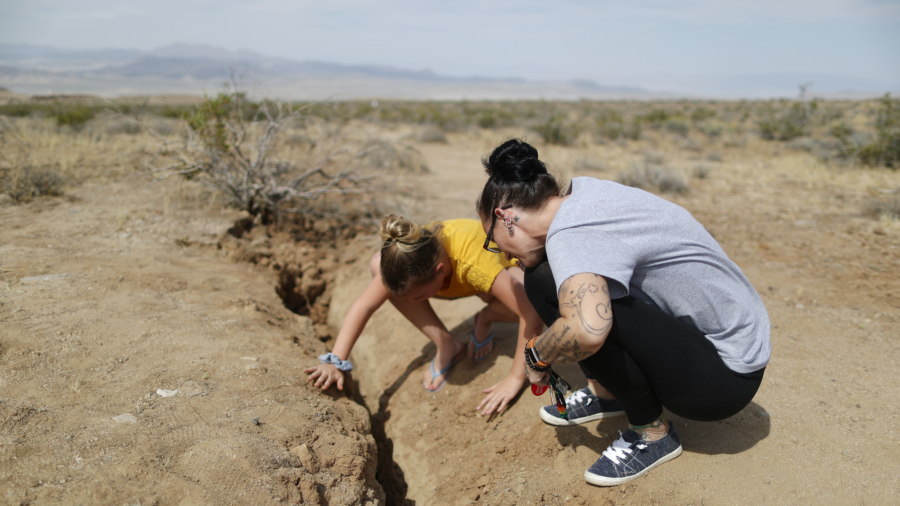
People were traveling to the cracks left in the Earth by two powerful earthquakes that struck last week in California to take pictures, with some climbing inside the cracks.
A 6.4 magnitude quake hit near Ridgecrest on July 4, followed by a 7.1 magnitude quake a day later.
Hundreds of aftershocks have also hit after the temblors.
Pictures showed people in the Mojave Desert examining the cracks and posing for photographs.


Lots of people checking out the crack in the road from the #Ridgecrestquake this morning. Some folks had major damage to their houses, some just broke a few dishes. #ridgecrest #earthquake pic.twitter.com/r2JBM4KYhe
— Emily Guerin (@guerinemily) July 5, 2019
I (of course) stuck my arm in it and it reached all the way up to my shoulder. pic.twitter.com/Yxs4sZHZJx
— Emily Guerin (@guerinemily) July 5, 2019
A girl stood with one leg inside of a rupture while two adults looked on. According to Getty, which published the picture, the trio were residents of nearby Ridgecrest.
Another picture showed the girl and a woman closely examining the crack.
Other pictures showed a man examining what appeared to be the same crack and several other men at a different rupture located near the epicenter along California State Route 178 between Ridgecrest and Trona.
One man, identified as local resident Steve Ault, was wearing a shirt that said “Ridgecrest Has Its Faults.”


The quakes left a surface rupture in the area that was visible from space.
Planet Labs released before-and-after satellite images showing the area before the quakes and after the temblors.
“Ridgecrest Earthquake before (4th July) and after (6th July) images from Doves [satellites] clearly showing surface rupture,” Planet Labs Co-founder and CEO Will Marshall said in a post on Twitter.
Ridgecrest Earthquake before (4th July) & after (6th July) images from Doves, clearly showing surface rupture. Thx @rsimmon @PlanetLabs @USGS RT @USGSBigQuakes Prelim M7.1 Earthquake 35.767, -117.605 Jul-06 03:19 UTC, updates https://t.co/waWvmvQZ88 pic.twitter.com/cUNxdMazum
— Will Marshall (@Will4Planet) July 7, 2019
#RidgecrestEarthquake
This view from above by KCSO Air Support Unit shows the damage to Hwy 178 from the earthquake.
Senior Deputy Riggs also shows the line you can see on the desert floor caused by the earth moving. This video was captured this weekend after both earthquakes. pic.twitter.com/1HUMReoMdJ— Kern County Sheriff’s Office (@KernCoSheriff) July 8, 2019
A video released by the Kern County Sheriff’s Office showed damage to Highway 178.
“Senior Deputy Riggs also shows the line you can see on the desert floor caused by the earth moving,” it said.
“This video was captured this weekend after both earthquakes.”


