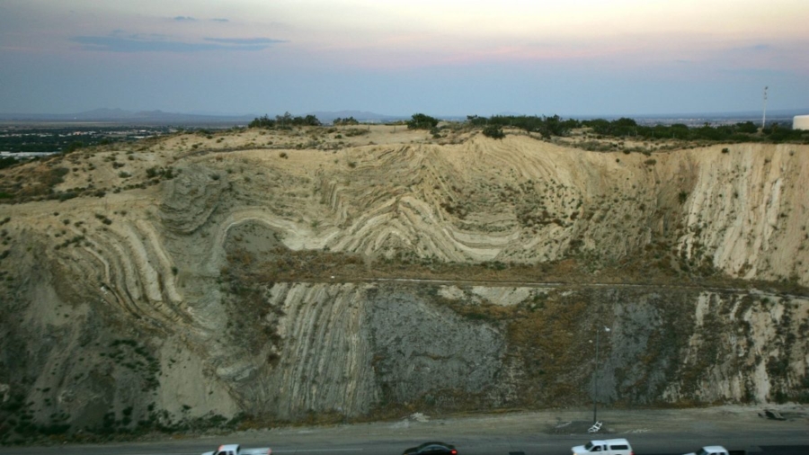
Seismic activity along the San Andreas fault in California could lead to a large earthquake by 2030, researchers said.
In the aftermath of two big quakes—a 6.4 magnitude quake on July 4 and a 7.1 magnitude quake on July 5—the United States Geological Survey (USGS) warned that another earthquake around the same magnitude could rattle the area within the next seven days.
The quakes hit in the Mojave Desert, in the Little Lake fault zone, more than 150 miles away from the San Andreas fault, USGS seismologist Susan Hough noted to KTLA. She said the quakes don’t affect the probability of quakes in other parts of California.
Other researchers said there wasn’t enough known to say that the recent quakes did not affect the San Andreas fault.

“We do not know of a definite relationship of these earthquakes to the San Andreas,” Glenn Biasi, a geophysicist with the survey who is based in California, told Live Science. “We don’t have a good way to assess the likelihood” that the quakes added stress to the fault, added Michele Cooke, a geoscientist at the University of Massachusetts-Amherst.
“The San Andreas hasn’t slipped in a long while. If the fault is loaded to the point where it is just about ready to slip, then it is possible that the recent earthquake could add just enough shear stress to the San Andreas to cause it to slip. Alternatively, the slip of these recent earthquakes could unclamp the San Andreas fault, making it easier to slip,” Cooke added.
Other researchers noted the probability or a major quake striking along the fault was already high.

“We are not changing our forecast for the San Andreas,” Paul Caruso, a geophysicist with the survey who is based in Golden, Colorado, told the New York Times. “We still believe there’s a 70 percent chance of a magnitude 7 or greater in Southern California before 2030.”
A similar prediction was made in a 1999 press release by the agency, which said at the time that “there is a 70 percent probability of at least one magnitude 6.7 or greater quake, capable of causing widespread damage, striking the San Francisco Bay region before 2030.”
San Francisco lies along the San Andreas fault and is also located near the San Gregorio and Hayward faults.
The last major earthquake to strike along the San Andreas fault was in 1906. A 7.9 magnitude quake struck near San Francisco, killing 3,000 people and demolishing parts of the city. The death toll remains the highest in U.S. history.

The survey noted that the 1989 Loma Prieta quake struck more than 50 miles away but still caused severe damage in San Francisco and Oakland.
There is a small chance of a quake similar in magnitude to the 1906 temblor happening in the next 30 years, the survey said on a recent “when will it happen again?” page. It pegged the odds at 2 percent, noting the best guess is that the type of quake seen then occurs at intervals of about 200 years.
“The real threat to the San Francisco Bay region over the next 30 years comes not from a 1906-type earthquake, but from smaller (magnitude about 7) earthquakes occurring on the Hayward fault, the Peninsula segment of the San Andreas fault, or the Rodgers Creek fault,” it stated.

On another page, the survey says that data gathered by earth scientists shows “that at many places along the San Andreas Fault, we have gone past the average time between large earthquakes.”
The fault zone has been moving for millions of years, the survey said, noting the zone is the main part of the boundary between the Pacific tectonic plate on the west side and the North American plate on the east side.
“The relative motion between these two tectonic plates is about two inches a year but that rate is distributed across all the faults that are part of the zone,” the survey stated.
“The faults are boundaries between blocks, and each block is constantly moving, which we can see by analyzing GPS (Global Positioning System) data. However, the edges of the blocks, the faults themselves, are stuck and only move where there is a large earthquake (some faults creep a little bit, but most are locked).
An earthquake occurs when the stress from the force of the moving plate overcomes the friction causing the plate boundary edges, the fault, to stick. The stuck section slips, and the edge of each block catches up to the rest of the plate. The plate is moving slowly all the time, but the edges move in fits and starts.”

