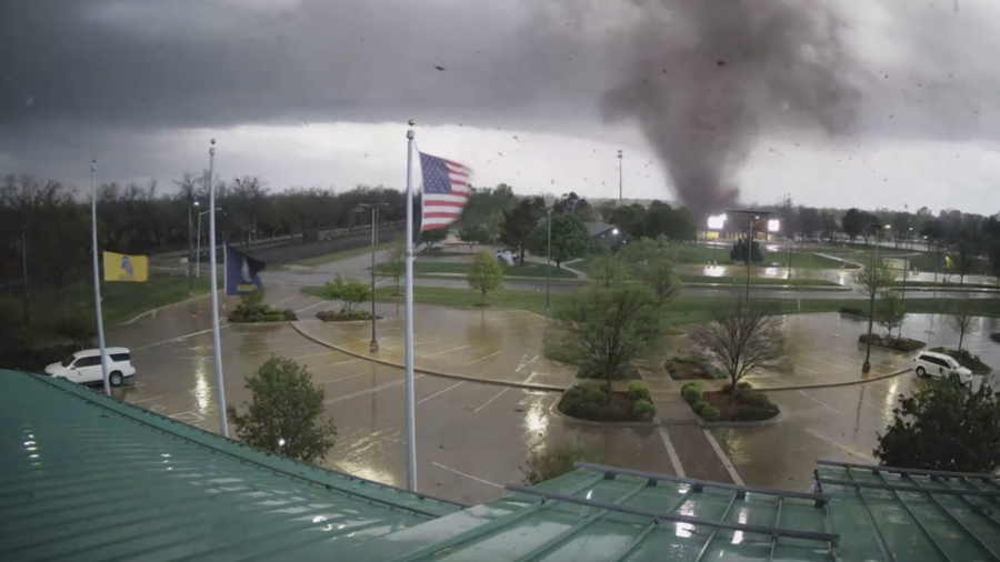
After producing damaging tornadoes across multiple states, a volatile storm system continues moving across the country.
For over a week, multiple storm systems have left people in the United States under the threat of severe storms.
“If a tornado is reported today, it will be the ninth consecutive day with tornadoes somewhere in the U.S.,” says CNN meteorologist Brandon Miller.
A tornado watch for over 3 million people in Georgia, Florida, and Alabama was issued by the Storm Prediction Center (SPC) on Friday afternoon. Another tornado watch covers northern Georgia, eastern Tennessee, western North, and South Carolina, southeastern Kentucky, southwestern Virginia and southern West Virginia. Nearly 10 million people are included in the watch area which spans the cities of Charlotte, Chattanooga, Knoxville, and Asheville.
A third watch includes much of central and eastern North Carolina, along with central and southern Virginia, as well as a few counties in West Virginia.
In all, about 21.6 million Americans are affected by the watches. A tornado watch means conditions are favorable for storms forming in the area to produce tornadoes.
Several major southern metropolitan areas are facing the threat of damaging winds, hail and a few tornadoes, with the weather taking aim at 70 million people across the Southeast and Mid-Atlantic.
The cities of Charlotte and Raleigh in North Carolina, and Virginia Beach and Norfolk in Virginia, are all under an enhanced risk for severe storms—Level 3 of 5.
This risk level means numerous severe storms are possible across the region.
The Storm Prediction Center (SPC) said the primary threat is expected between late morning and early evening.
So, just because the sun comes out, don’t let your guard down if you are in these risk areas on Friday.
Heavy rain of up to three inches will create a flood threat in the Mid-Atlantic.
“Rainfall totals up to 3 inches are possible and could create scattered flooding concerns in these areas,” the WPC said.
Flood watches are posted for parts of six states from Kentucky to Maryland, including Washington, DC, and Baltimore along with other cities.
On Saturday, the storm system will slowly move off the East Coast.
“This will lead to a very dreary weather pattern to develop and linger across parts of the Northeast and down into the Mid-Atlantic through the weekend,” the Weather Prediction Center said. “Much of the Eastern Seaboard will be under the influence of overcast skies, gusty northeasterly winds, and occasional rain with high temperatures only reaching into the 50s.”
This is a stark contrast to the 100-degree temperatures forecast across Texas and the Southern Plains this weekend.

