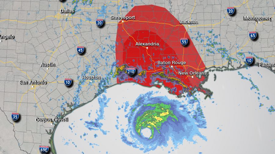
In addition to catastrophic storm surge, damaging winds, and heavy rain, Laura will also likely produce several tornadoes and waterspouts.
“Hurricanes and tropical storms that make landfall in the Gulf of Mexico are more likely to produce tornadoes compared to storms in the Atlantic,” explains Brandon Miller, CNN meteorologist.
However, not all coastlines on the Gulf of Mexico are equally threatened.
“Note that this is less true for Texas landfalls in the Gulf—since the coastline angles more south to north like the Atlantic East Coast, rather than east to west like in the northern Gulf of Mexico coastline of LA/MS/AL/FL Panhandle,” Miller clarified.
In other words, a tropical system that landfalls in Louisiana, which looks likely for Laura, could produce a few more tornadoes than a landfall in say, Galveston, Texas.
Take Hurricane Katrina for instance, when the storm first made landfall in Florida on August 25, 2005, there was only one tornado report—in the Florida Keys. But several days later, when Katrina made a second landfall, this time in Louisiana, on August 29, 2005, there were 20 tornado reports. This was at least partly due to the angle of the storm as it made landfall.
In total, 33 tornadoes were reported from Katrina. Interestingly, a majority of those tornadoes were in Georgia, some of them occurring north of Atlanta.
“After the events of Hurricane Katrina, the national weather Service conducted several tornado surveys throughout the state of Georgia and were able to verify at least 18 tornadoes touched down in the state from outer bands of Katrina,” says Kyle Thiem, meteorologist for NWS Atlanta office. “At the time, 18 tornadoes set a record for the most tornadoes ever reported in the state of Georgia on a single day in the month of August.”
This is important to note because the threat of tornadoes is not limited to the coastline or to the day of landfall. Often, the day after landfall can produce more tornadoes than on the landfall day itself, and they can occur hundreds of miles inland.
“You can get more dry air in upper levels that can actually increase the tornado threat by increasing the instability,” explains Miller.
For example, during Hurricane Rita, there were 39 tornado reports when the storm made landfall on September 24, 2005 in Louisiana. But the following day, there were 47 tornado reports. Rita spawned an estimated 90 tornadoes over the southern United States.
With Laura, the “Slight Risk” level 2 issued by the Storm Prediction Center covers a much larger area on Thursday than it did the day before. On Wednesday, there’s a risk of tornadoes in Louisiana only. On Thursday, the tornado risk expands into Mississippi and Arkansas.
Tornadoes may occur more frequently near the eye of hurricanes than we realize, according to Miller—but the winds are so strong and the destruction is so great around the eye, storm survey teams cannot determine what damage may have come from a brief tornado versus the damage from the extremely strong and persistent winds within a hurricane’s eyewall.

