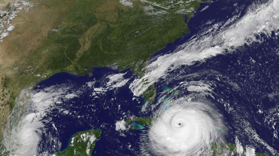
Several tornados may spring up across south Florida beginning on Saturday morning as Hurricane Irma begins to affect the state, according to the 5 p.m. advisory from the U.S. National Hurricane Center (NHC).
Meteorologists have ruled out all scenarios of the storm missing Florida and now predict a direct hit, with the only uncertainty being which part of the state will bear the bulk of the storms devastating punch.
“No doubt if landfall in Fla. anymore, just a matter of exactly where who gets the worst damage. Hurricane force wind gusts peninsula wide, said Dave Epstein, a meteorologist with CBS.
Hurricane Irma will remain a powerful category 4 storm, the NHC said, with landfall anticipated after 2 p.m. on Sunday.
“Irma is expected to make landfall in Florida as an extremely dangerous major hurricane and will bring life-threatening wind impacts to much of the state regardless of the exact track of the center,” NHC said.
Southwest Florida is expected to face significant flooding from storm surge with waters rising up to 12 feet above ground level, according to NHC.
As of 5 p.m., Irma was moving west at 12 mph with maximum sustained winds of 155 mph.
Flooding is expected to be the worst along the southwestern coast of Florida from Captiva to Cape Sable, with the water rising 8-12 feet above the ground and accumulated rainfall of up to 20 inches the NHC said.
The area from Cape Sable to Boca Raton, including the Florida Keys will see waters rise 5-10 feet. Other parts of the coast will see water rise at least 3 feet.

“The deepest water will occur along the immediate coast in areas of onshore winds, where the surge will be accompanied by large and destructive waves,” NHC said.
The level of flooding would depend on a number of factors. In a worst-case scenario, peak storm surge would occur during a high tide, with potentially catastrophic consequences.
Hurricane Irma reached historic proportions and broke several hurricane records as it moved west over the Atlantic Ocean.
The death toll from the havoc the storm wreaked on its way rose to 21 people on Friday. Some islands were virtually flattened with photos showing extreme devastation.

“We are running out of time. If you are in an evacuation zone, you need to go now. This is a catastrophic storm like our state has never seen,” Florida Gov. Rick Scott said, adding that the storm’s effects would be felt from coast to coast in the state.
U.S. President Donald Trump said in a videotaped statement that Irma was “a storm of absolutely historic destructive potential,” and called on people to heed recommendations from government officials and law enforcement.
Mass evacuations are ongoing in Florida as residents flee the state for safety.
The storm earlier pummeled the Turks and Caicos Islands after saturating the northern edges of the Dominican Republic and Haiti.
Irma was downgraded to a Category 4 on Friday but remains giant in size and extremely dangerous.
Reuters contributed to this report.
From NTD.tv

