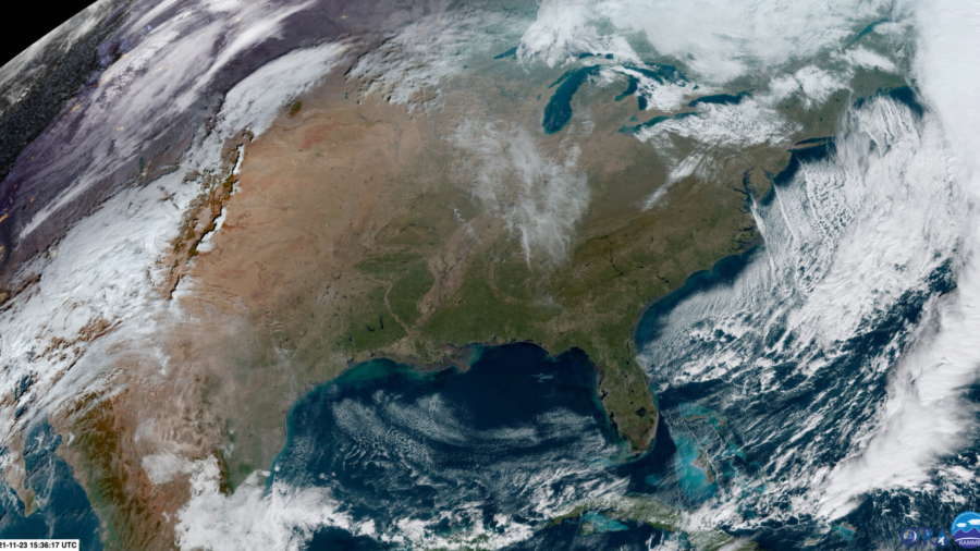
About two-thirds of the country should be truly thankful for the weather this holiday season as Thanksgiving travel picks back up to pre-pandemic levels.
“A relatively tranquil stretch of weather persists in the final days leading up to Thanksgiving,” says the Weather Prediction Center (WPC).
It only takes a run-of-the mill rain shower or wind gust to push travel delays from a couple of minutes to hours the day before Thanksgiving. The good news is, we don’t expect much weather to impact the country Wednesday. Thursday looks like more of a soaker for some and those pesky winds and cold air return to the Northeast on Friday into Saturday.
No matter what, some delays will mount on the roadways in airports, just due to the extra volume.
Here are the few places the weather may add to travel delays.
The Final Travel Day Before the Holiday
“With Thanksgiving just a couple days away, Mother Nature is providing a suitable weather pattern for travelers across the vast majority of the U.S. mainland through Wednesday night,” the WPC said Tuesday.
In the Northeast, winds have been the story the week leading up to Thanksgiving. The good news is those should subside in the Northeast on Wednesday.
Some wind gusts from Dallas to Chicago could cause some issues, but delays shouldn’t be major. Winds in some areas could gust up to 40 mph.
In Southern California, the Santa Ana winds begin to pick up through the day Wednesday. Winds are likely to gust from 30 to 60 mph. This could prove to add some delays at airports but will become more problematic on Thanksgiving.
The Intermountain West could see some snow showers Wednesday, making the perfect arrival for anyone hitting the ski slopes for Thanksgiving.
Right now, there is a 20 percent chance that this snow makes it down into Denver.
The city has officially broken the record for the latest “first measurable snow,” and is still waiting. Measurable snow is 0.1 inches or greater and Denver has logged snow amounts since 1882. The last time the city had snow was 216 days ago.
In the Northwest, residents will get a slight break Wednesday from the onslaught of Pacific storms they have endured over the last few weeks.
But rain will be in the picture Wednesday evening. This next storm system will be a bit warmer, increasing the flood threat in the river valley below.
“A weather system will bring rain to the area Thursday and Friday,” the Seattle National Weather Service (NWS) says. “Rising snow levels combined with heavier rain will cause rivers to rise during this period, with river flooding possible.”
Overnight Wednesday into Thanksgiving Day, a storm system will build over the Plains.
“As its trailing cold front advances east through the nation’s mid-section mid-week, this sets the stage for scattered showers to break out from the Lower Great Lakes to the South Central U.S. Wednesday night,” the WPC says.
Thanksgiving
This advancing cold front will bring showers and thunderstorms in the early-morning hours. These storms will then “push into the Ohio and Tennessee valleys later in the day on Thanksgiving with locally heavy rainfall possible in southeast Texas,” the WPC says.
The rest of the country looks set to stay dry this Thanksgiving.
“The regions most likely to stay dry on Thanksgiving are the Southwest, Intermountain West, Midwest, and much of the East Coast,” the WPC says.
In some areas, such as the drought-stricken areas of the Southwest, dry is not what they want to see.
“An extended duration of very dry and warm weather will return through the holiday weekend,” the Los Angeles NWS says. This, combined with the moderate Santa Ana wind event forecast, will bring critical fire conditions to the region.
Temperatures will have normalized or pushed above average for most of the country, except for the central US, where temps will fall below normal.
This cold will push east, along with the rain Thursday night.
Weather Conditions for the Return Travel
The cold front will have pushed through the East Coast by Friday morning, with some rain still lingering for some.
Maximum temperatures from Texas to Maine will be anywhere from 5 to 15 degrees below normal Friday and Saturday.
Behind the front, not only will the bottom drop out on the temperatures, but the wind will kick up again.
“Right now, looking at sustained winds at 15 to 25 mph, with gusts of 25 to 35 mph,” the New York NWS office says.
This is the one element that travelers should be prepared for on Friday.
The wind is one of the main culprits to travel delays in the late autumn and winter months.
In addition, these winds whipping across the Great Lakes are likely to force lake effect snow into the weekend.
Later in the weekend, a quick-moving storm system could bring a quick shot of snow to the Midwest and Great Lakes.
In the Northwest, another system pushes through with more rainfall over the weekend.
Overall, the weather will have some impact on travel, but it won’t be the ginormous snarl of mounting airport delays we have seen in some years. Something to be thankful about, for sure.


