

Another storm system on Tuesday is threatening areas recently hit by deadly tornadoes, where residents now also are dealing with the impacts of coronavirus.
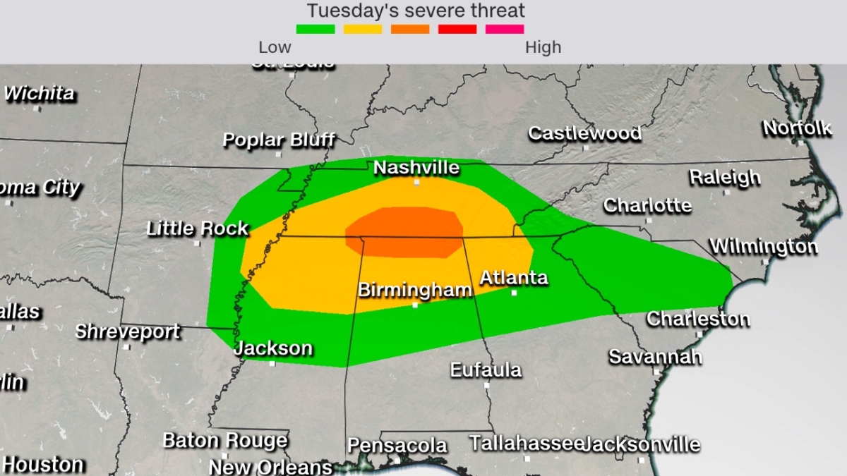
"Central Tennessee, including the Nashville area, once again find themselves at risk for tornadoes later today," CNN meteorologist Brandon Miller said.
"Unlike a couple of weeks ago, when tornadoes moved through after midnight while residents were asleep, today's threat looks to be greatest earlier in the evening, likely between 6 and 10 p.m. Central Time."
The prediction center elevated the risk level to enhanced—level 3 of 5—early Tuesday afternoon for northern Alabama and portions of southern Tennessee.
Coronavirus—and efforts to keep people apart to stem its spread—brings a new challenge to storm safety in the risk areas.
"In the case of a weather event necessitating storm shelters Alabama, Public Health recommends that your first priority should be to protect yourself from the storm," tweeted the city of Tuscaloosa, Alabama.
Inside storm shelters, officials will try to maintain 6 feet of space between people, officials added.
Memphis and Chattanooga, Tennessee, are in the slight risk area—level 2 of 5—for severe storms that may produce damaging hail and wind, along with a few tornadoes, the prediction center said.
Severe thunderstorms are also possible into Tuesday night across eastern Arkansas, northern Mississippi, northern Alabama and northwest Georgia.
Flash Flooding Likely for the Same Region
In addition to strong thunderstorms, heavy rainfall could lead to flooding across many of the same areas."The greatest risk of flash flooding with this storm will be across portions of the Upper Tennessee Valley into the Southern Appalachians where soils are saturated from heavy rains over the past few weeks," the prediction center stated.
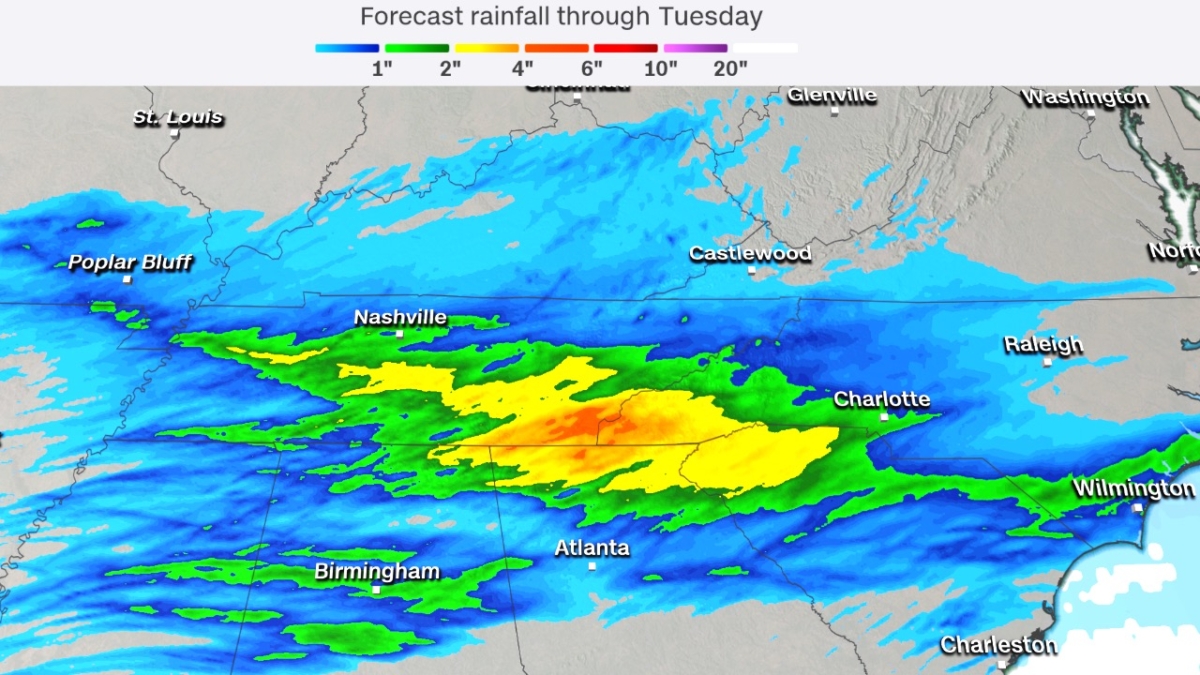
The risk level is 3 of 4 for flash flooding Tuesday across a zone that includes the cities of Huntsville, Alabama; Chattanooga and the northern Atlanta suburbs. Two to 4 inches of rain could fall in this region, only a day after widespread rainfall of 1 to 3 inches fell there.