


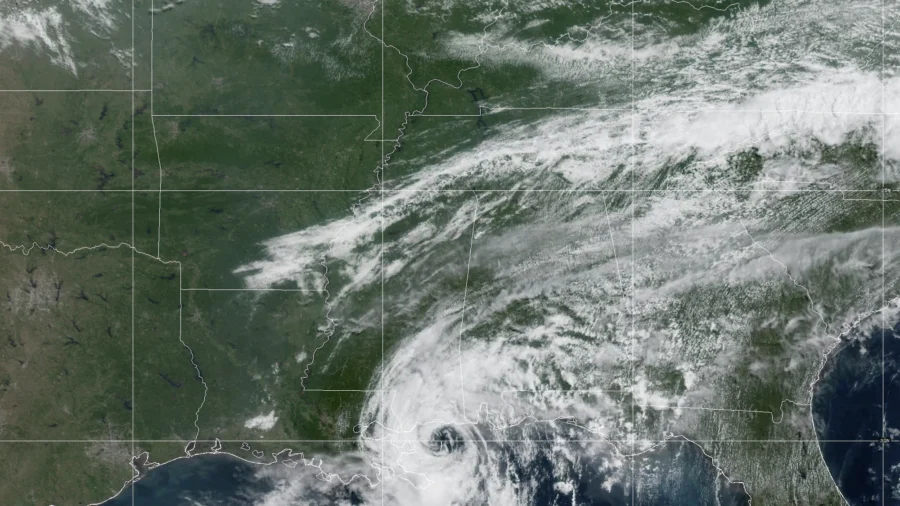
Tropical Storm Bertha is on track to make its second U.S. landfall Thursday afternoon along the upper Texas coast, prompting officials to urge coastal residents from Louisiana to Texas to finalize storm preparations and heed local evacuation guidance as tropical storm warnings remain active.
As of 10 a.m. CDT Thursday, Bertha's center was located about 100 miles east-northeast of Galveston, Texas, and roughly 35 miles south of Lake Charles, Louisiana, moving west at 10 mph with maximum sustained winds of 45 mph, according to the National Hurricane Center's 17th advisory. Forecasters said the storm will track along the Louisiana and upper Texas coasts through the day before moving inland over Texas this evening, where it is expected to weaken into a tropical depression and dissipate late Thursday night or Friday.
A tropical storm warning remains posted along the Gulf Coast from Morgan City, Louisiana, to Sargent, Texas, meaning tropical storm conditions are expected within the area within 24 hours. The National Weather Service in Houston/Galveston described Bertha as a "disorganized" and "very asymmetrical" system battling high wind shear, dry air, and land interaction as it approaches, but said no significant impacts to Southeast Texas are expected at this time, according to the National Weather Service Houston/Galveston.
Evacuation Guidance and Local Warnings
Officials in both Texas and Louisiana instructed residents to follow the direction of local authorities regarding evacuations rather than issuing blanket mandatory orders. The Lake Charles office reported Bertha's center was about 70 miles east of High Island, Texas, moving west at 10 mph, and warned that wind and storm surge impacts were "now unfolding" along the immediate coastline.Meanwhile, the National Weather Service in New Orleans canceled all remaining watches and warnings for Southeast Louisiana and South Mississippi, noting the storm had already passed west of the area and that minor to moderate coastal flooding of 1 to 2 feet had been observed during the morning high tide. That office said its Thursday statement would be the final local advisory issued for the region regarding Bertha.
Surge, Wind, and Rip Current Risks
Forecasters expect a storm surge of 1 to 2 feet above ground level from Port Bolivar, Texas, to Port Fourchon, Louisiana, if the peak surge coincides with high tide. Tropical-storm-force winds extend up to 160 miles from Bertha's center, and rainfall totals of 2 to 4 inches, with isolated amounts up to 6 inches, are possible along the Texas Gulf Coast and South Texas through Thursday night, raising a risk of isolated flash flooding in urban areas. A high risk of life-threatening rip currents is expected along Gulf beaches through Friday.Sandbags and Storm Assistance
Louisiana's Governor's Office of Homeland Security and Emergency Preparedness said self-service and full-service sandbag distribution sites remained active across multiple parishes, including Terrebonne, Lafourche, St. Charles and St. Martin, with residents generally asked to bring their own shovels, according to the Governor's Office of Homeland Security and Emergency Preparedness. The agency also said Lafourche and Pointe Coupee parish residents can now apply for FEMA assistance.Officials additionally warned residents to watch for scammers posing as FEMA or GOHSEP representatives, stressing that legitimate disaster agencies "will NEVER ask for an upfront payment or processing fee to receive aid.”