
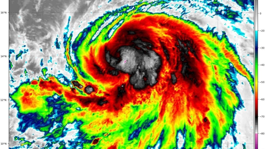
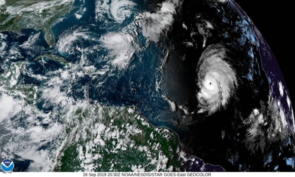
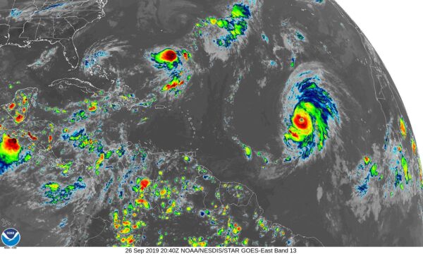
MIAMI—Forecasters say Lorenzo has become one of the largest and most powerful hurricanes on record in the central tropical Atlantic.
The U.S. National Hurricane Center says Lorenzo grew Thursday to a dangerous Category 4 storm with top sustained winds of 130 mph (215 kph). It says the hurricane could strengthen further still. Hurricane-force winds extend out up to 45 miles (75 kilometers) from the storm’s center.
On Thursday, Lorenzo was located Thursday about 1,055 miles (1,695 kilometers) west of the southernmost Cabo Verde Islands. The storm poses no immediate threat to land as it moves west-northwest over the central Atlantic at 13 mph (20 kph). Lorenzo is slated to move to the north and then northeast.
Over the coming days, the storm “will subsequently interact with an upper-level trough during recurvature, which should cause a period of increased shear and some weakening of the cyclone around” two days later, the agency said.
Elsewhere, Tropical Storm Karen strengthened slightly Thursday about 405 miles (650 kilometers) south-southeast of Bermuda. Top winds are clocking 45 mph (75 kph).
For both storm systems, there are no coastal watches or warnings in effect.
Earlier in the week, the storm unleashed floods and damaged properties on other Caribbean islands, including Trinidad and Tobago, according to video images that showed people using shovels to clear mud-covered roadways.
Karen, the 11th named storm of the 2019 Atlantic hurricane season, formed on Sunday afternoon east of the Lesser Antilles.
Puerto Rico, beset with financial woes and political turmoil, averted a potential new disaster last month when Hurricane Dorian skirted past it before laying waste to the northern Bahamas. Two years ago, Puerto Rico was still recovering from Hurricane Irma when it took a direct hit from Hurricane Maria. At least 3,000 people perished in that storm, the deadliest in the island’s recorded history.