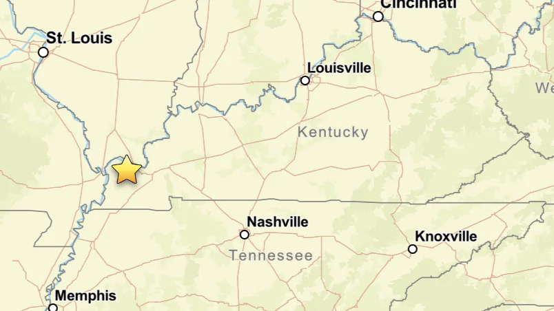
A magnitude 2.5 earthquake rattled western Kentucky late Wednesday, about 12 minutes before an EF-1 tornado touched down amid powerful storms sweeping the region, damaging buildings, closing roads, and leaving thousands without power.
The earthquake struck at about 11:35 p.m. near Paducah,
according to the U.S. Geological Survey (USGS). It originated about 8 miles underground near Barkley Regional Airport in McCracken County.
At least 59 people
reported feeling the earthquake to the USGS.
Meanwhile, a tornado warning was in effect at the time for parts of Ballard, Carlisle, Graves, and McCracken counties, including communities near the earthquake’s epicenter. The National Weather Service in Paducah was
tracking tornado-producing storms moving across northern Graves County.
According to the National Weather Service, an EF-1 tornado touched down at 11:47 p.m., three miles east-southeast of Cunningham. It moved southeast across Kentucky Route 849 near the Graves-Carlisle county line before lifting along Morrill Road at 11:49 p.m.
The two-minute tornado snapped or uprooted numerous trees but caused no injuries or deaths, according to Kentucky's Heartland News.
An intense macroburst followed the tornado, producing winds estimated at 80 to 105 mph across northeastern Carlisle and northern Graves counties. The powerful winds caused significant damage across a much larger area, according to the Weather Service.
Carlisle County Emergency Management
said: "EF1 tornado touched down near the intersection of County Road 1011 and CR 1012 traveling southeast into Graves County. Winds reached 100mph in the storm. This is the only confirmed tornado location."
“Other locations in the county experienced a macroburst with winds reaching 105mph,” it stated.
The Graves County Sheriff’s Office
reported property damage, fallen trees, and power lines blocking roads around Mayfield and northern Graves County.
Mayfield Electric & Water Systems
said strong winds caused outages, with crews working to restore service.
"The storms and strong winds that just moved through our area have caused power outages throughout the city," it stated, adding: "Please stay safe and remember to stay away from any downed power lines."
Kentucky Geological Survey seismologist Seth Carpenter
told WKYT that there’s no evidence tornadoes can trigger earthquakes, calling last night’s storm and quake “coincident but unrelated.”
He said the earthquake happened near the edge of the New Madrid Seismic Zone. “Earthquakes on these faults are to be expected, it’s not unexpected just because of the continual accumulation of energy ... the exact timing of when one will happen ... we simply don’t know,” Carpenter said.
The New Madrid Seismic Zone is an active fault system extending through parts of Kentucky, Tennessee, Missouri, and Arkansas. Thousands of small-to-moderate earthquakes are recorded in the region,
according to the USGS.
The Kentucky Geological Survey says that the New Madrid zone normally records two to four earthquakes of magnitude 3.0 each year.
The New Madrid Seismic Zone produced three major earthquakes, each estimated at magnitude 7.0 or 8.0, during the winter of 1811-12. The quakes destroyed settlements along the Mississippi River, altered the landscape, and were felt as far away as Connecticut, South Carolina, and Louisiana,
according to the USGS.