
Tropical Depression 25 strengthened into Tropical Storm Gamma in the western Caribbean Sea on Friday, according to the National Hurricane Center.
Tropical storm watches and warnings remain in place for portions of the Yucatan Peninsula in Mexico. The storm's maximum sustained winds are currently 40 mph and additional strengthening is expected before Gamma makes landfall on the Yucatan Peninsula on Saturday, according to the hurricane center.
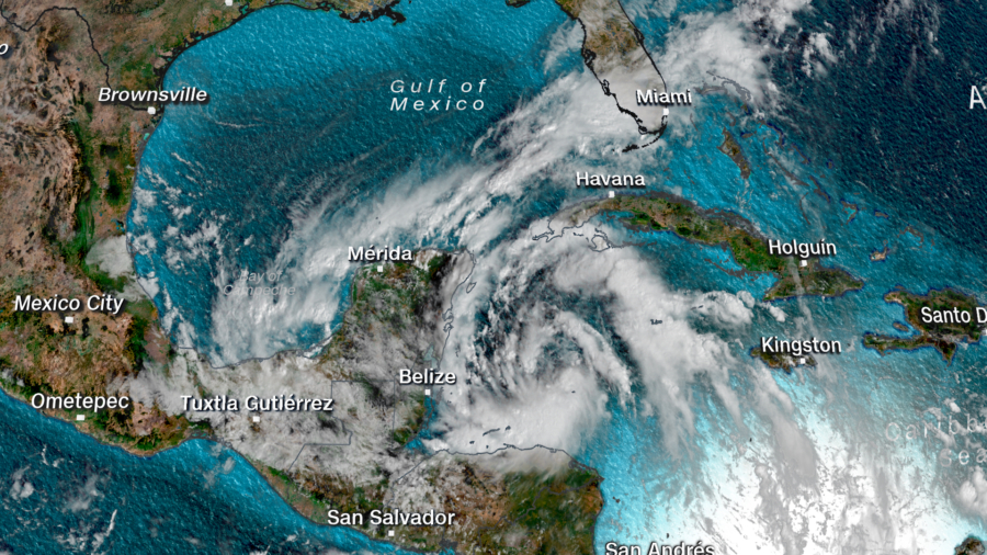
As of 11 p.m. ET, the storm is located 110 miles south-southeast of Cozumel, Mexico.
The system is expected to move slowly in and around the Yucatan Peninsula and the southern Gulf of Mexico over the next 5 days. And it could produce life-threatening flash floods and mudslides in eastern Mexico.
The Hurricane Season Isn't Over
This is only the second time in history that the Greek alphabet has been used when the original list of 21 storm names is completed. In 2005, Tropical Storm Gamma formed much later in the season, during the second week of November.The Atlantic hurricane season has already been very active, but it's not over yet. The season does not end until Nov. 30, but some years storms have continued well after that.
Ultimately, Gamma is not expected to become a major hurricane, but certainly it is worth watching, especially as it moves into the Gulf of Mexico and strengthens.
October Storms Are Not Rare
During an average season, we see about two named storms in October and one in November. Which means that if this were a "normal" hurricane season, we would still likely have a few more storms possible through the end of November. But this year is not a "normal" season. It has been forecast for months to be very active."If you are looking at other notable October storms that have impacted the Gulf Coast in recent years, look no further than Hurricane Michael, which formed in the same area of concern we are watching today," said CNN meteorologist Michael Guy.
Hurricane Michael formed southeast of the Yucatán Peninsula on Oct. 1, 2018, strengthened into a named storm on Oct. 7, and then made landfall as a Category 5 hurricane near Mexico Beach, Florida, just 3 days later.
So far this season, there have been 23 named storms. The average for an entire season is 12.
Back in August, the National Oceanic and Atmospheric Administration updated the hurricane season forecast and called for 19 to 25 named storms. Before this, the agency had never forecast up to 25 storms in a season.