
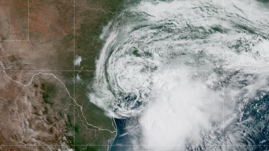
National Hurricane Center forecasters were monitoring Tropical Storm Arthur—designated the first potential Atlantic cyclone of the season—as it made landfall June 17 on the southern coast of Texas.
Earlier in the day, the NWS issued flash flood warnings for parts of Houston.
Isolated areas could see up to 20 inches of rainfall, Brennan said.
Forecasters were closely watching the storm to possibly develop into a cyclone as it travels northeast along the Atlantic Coast and Southeast U.S. coastal region, according to the NWS.
A low-pressure area near the middle Texas coast had produced sustained convection east of its center this morning, the hurricane center reported.
“We found enough wind observations from the Air Force Reserve hurricane hunters who are flying out in the storm, as well as some coastal observations, that suggest maximum sustained winds are up to about 40 miles per hour now,” Brennan said.
Tropical Storm Arthur is moving northeast at about 9 miles per hour today and is expected to speed up, the weather center reported. The system is expected to move northeast along the Texas coast during the day and move inland over southwestern Louisiana by the evening.

Surface measurements showed maximum sustained winds increased to almost 45 miles per hour with higher gusts. The wind speeds were forecast to weaken when the storm moves inland, the NWS reported.
It said tropical-storm-force winds extended about 175 miles from the center of the storm, reaching Galveston, Texas.
Ongoing heavy rain would prolong the flooding into the weekend, according to the center.
It said that minor to moderate coastal flooding is also expected along portions of the upper Texas and Louisiana coastlines on June 17.
As much as 4 to 8 inches of rain is forecast from South Texas to eastern Alabama, with some parts of the region receiving up to 12 inches over several days, AccuWeather predicted.
The Neches, Guadalupe, Brazos, San Antonio, Trinity, Colorado, and Nueces rivers in Texas were expected to be at most risk of flooding, AccuWeather said.
The storm is also forecast to bring storm-force wind gusts up to 60 miles per hour and rough surf with choppy seas for much of the week over the northwestern third of the Gulf.
A storm surge of 1- to 3-feet is anticipated from the upper Texas coast to the Louisiana coast, with some higher amounts possible when the storm moves inward, AccuWeather said.