
The National Weather Service (NWS) severe thunderstorm warnings are in place for areas of New York, including in Brooklyn, New Jersey, the Lower Hudson Valley, New York City and western Long Island, until 11 p.m. local time, on Tuesday, May 28. It earlier issued a tornado warning for parts of New York City and northern New Jersey until 10:15 p.m. local time.
"Flying debris will be dangerous to those caught without shelter. Mobile homes will be damaged or destroyed. Damage to roofs, windows, and vehicles will occur. Tree damage is likely," NWS said in a statement. "This Tornado Warning replaces the Severe Thunderstorm Warning issued for the same area."
The NWS also confirmed a tornado has formed in eastern Pennsylvania where homes were damaged without immediate reports of injuries. City officials are urging the public to take shelter immediately on lower floors and to stay away from windows.
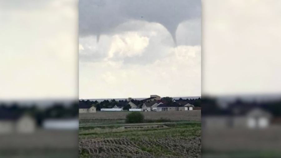
Earlier, a massive tornado in northeast Kansas has caused widespread damage late May 28, while states in the nation's Midwest brace for a wave of powerful storms, according to local reports.
Warnings Canceled
Severe weather warnings in Kansas have been canceled after NWS issued a reassuring update around 8:30 p.m. local time but the tornado watch remains until 10:00 p.m.Mile Wide Tornado Warnings Earlier
Parts of the Kansas City metro had an tornado warning, which was forecast to bring rain and measure about a mile wide, according to KMBC.NWS later canceled the tornado warning after reporting debris was falling from the sky.
"Although the warning has been cancelled, don't let your guard down," NWS representatives said according to KMBC. "Hail and strong winds are still possible, so stay inside and be prepared to take shelter if necessary."
A tornado warning was earlier issued for parts of Douglas, Franklin and Osage Counties in Kansas, according to KCTV5.
There has been some damage reported in Pleasant Grove, south of Lawrence.
The Douglas Co. Emergency Management confirmed with WIBW a "large and destructive" tornado destroyed several houses south of Lawrence, Kansas.
Kansas City International Airport previously announced they were moving customers to a shelter due to a severe weather threat.
In Wyandotte County, Director of Emergency Management Matt May said as of 8:15 p.m. there was no significant damage, just minor debris according to what his crew had gathered in their early stages of damage assessment.
“It’s mostly been what I call tornado wrap—typically large pieces of metal that the wind catches them and rips them off, signage, metal roofs off of buildings, those kinds of things. Sometimes it’s debris that’s not from our area,” May told KCUR.
More tornadoes hit the Dayton, Ohio area on Monday night.
This story is developing. Check back for updates.