
A volatile storm system—with significant damaging winds and tornadoes—will take shape in the U.S. toward the end of the week
"This system is significantly more like a March storm than a January storm," CNN meteorologist Chad Myers says.
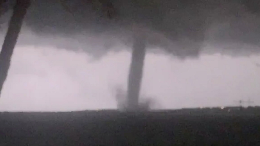
All of the ingredients—cold air to the north, warm moist air to the South and strong upper-level winds—are there for a significant severe weather event Friday through Saturday across the South.
It covers nearly 10 million people in parts of East Texas, southeast Oklahoma, much of Louisiana and Arkansas; the threat includes Houston and Shreveport, Louisiana.
Severe storms will develop on Friday afternoon and likely last well into the evening.

"Vigorously rotating supercells will have the potential to produce tornadoes, hail and significant straight-line wind damage," says Myers.
The more significant storms appear more likely across the area from late afternoon into the overnight hours.
Saturday, the storm system will shift East, stretching the risk area for damaging severe storms from eastern Louisiana to Georgia.
"The only limiting element that may reduce the chances of a full-fledged tornado outbreak will be a slight lack of humidity at the surface," says Myers. "All other factors are in place."
The Snowy Side of the Storm Could Leave People Slipping and Sliding
While storms will pop in the South, snow is expected to the north. Snow and ice will develop from the Plains into portions of the Midwest.Heavy snow could develop from portions of Oklahoma to Illinois on Saturday and Sunday.
Also, a band of freezing rain could mix in with the snow, bringing dangerous travel conditions for much of the same areas.
Flooding Is Likely in the Warmer Section of Storm
If severe weather, snow and ice weren't enough, there's also a flooding component to this system."Rain rates approaching 1 inch an hour is very possible with this event," the Weather Prediction Center said in its forecast discussion.
Heavy rain could develop from the Deep South to the Ohio Valley.
Several inches of rain is possible from North Texas into Oklahoma, as well as parts of the Mississippi River Valley.