
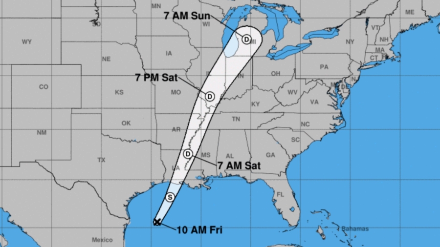
Tropical Depression 17 strengthened into Tropical Storm Olga on the afternoon of Oct. 25, with forecasters saying it will bring 2-4 inches of rain to the central Gulf Coast and into the Mississippi Valley through Saturday morning.
A tropical depression has wind speeds of less than 39 mph, while a tropical storm can reach wind speeds of up to 73 mph. Olga had winds of 40 mph.
Olga will move into Louisiana late Friday as it merges with a cold front. That combination should bring rainfall. Isolated amounts over 4 inches are possible.
"The main threat from the system will be heavy rain," CNN Senior Meteorologist Dave Hennen says. "Over 8 million are under flash flood watches in the South. Cities like New Orleans, Jackson and Memphis could see flooding later today into tomorrow."
There is a marginal to slight risk of flash flooding.
The National Weather Service has issued a tornado watch in effect for parts of Alabama and Mississippi. The National Weather Service warns of isolated gusts of wind up to 65 mph and the possibility of hail.
"This system is a bit of a hybrid," Hennen says. "It will likely not remain tropical for long as it gets absorbed in a frontal system moving through the Gulf. Even though that is the case, it will still have impacts along the Gulf Coast with winds of 40 to 50 mph possible, along with heavy rain and even a storm surge."