

Winter Weather: 2026–2027 Farmers’ Almanac Predicts 'Plenty of Surprises'

The outlook calls for a more active southern storm path during winter 2026-27, with milder periods interrupted by shorter bursts of cold and snow farther north.
Published: 8/7/2026, 10:56:39 PM EDT
Winter Weather: 2026–2027 Farmers’ Almanac Predicts 'Plenty of Surprises'
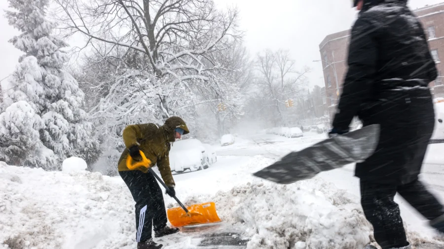
People shovel snow in the streets of Brooklyn as blizzard conditions continue in New York City on Feb. 23, 2026. (Spencer Platt/Getty Images)
The Farmers’ Almanac is predicting a winter of sharp contrasts and “plenty of surprises” across the United States, including frequent southern storms, sudden northern cold snaps, and a mix of rain, ice, and heavy snow in the Northeast.

The outlook calls for a more active southern storm path during winter 2026–2027, with milder periods interrupted by shorter bursts of cold and snow farther north.

“In other words, prepare for a winter of snow, sleet, and surprises,” it stated on Aug. 6, and advised: “Keep the snow shovel, rain boots, and ice scraper close at hand. This winter, you may need all three.”

The National Oceanic and Atmospheric Administration's (NOAA) latest seasonal outlook also supports the possibility of a wet southern winter as El Niño strengthens in the Pacific Ocean. NOAA reported an 81 percent chance that it will become very strong from October through December 2026, and a 97 percent chance that El Niño will continue into early spring 2027.

El Niño, according to NOAA, is a climate pattern marked by unusually warm Pacific Ocean waters that disrupts weather, often causing more rain in the southern United States and dry weather in the western Pacific.

The Farmer’s Almanac also predicts El Niño will likely play a major role this winter, bringing wetter-than-normal conditions to the southern states.

“An active storm track may extend from Southern California and the Desert Southwest through Texas, the Gulf Coast, and the Southeast. These areas should watch for frequent storm systems, muddy fields, and occasional surges of cold air,” it states. “When that colder air meets abundant moisture, some storms could produce sleet, freezing rain, or heavy, wet snow. The southern Rockies may fare especially well for mountain snowfall.”

South, Southeast, and Southwest

Southern California, the Southwest, Texas, the Gulf Coast, and the Southeast could see repeated storm systems and above-normal precipitation, according to the Almanac.

Cold air reaching that moisture could create periods of freezing rain, sleet, or heavy, wet snow. The southern Rockies could also receive increased mountain snowfall.

NOAA’s seasonal outlook also favors a wetter winter across much of the southern tier, with the strongest movement in parts of the Southeast. A wetter season could bring relief to drought-stricken areas, but repeated heavy rain could also increase flooding and travel risks.

Northwest, Plains, and the Great Lakes

The Almanac expects changing conditions across the Northwest and a less dependable mountain snow season. The northern Plains, Upper Midwest, and the Great Lakes could experience mild stretches broken by fast-moving snow, strong winds, and brief periods of bitter cold.

NOAA favors below-normal winter precipitation from the Northwest into the north-central United States and the Great Lakes. Temperatures are more likely to run above normal across much of the northern tier.

“Below-normal precipitation is indicated for parts of the Pacific Northwest, parts of the Southern Plains and Lower Mississippi Valley, and parts of the Upper Mississippi Valley and Upper Great Lakes,” NOAA predicted.

Northeast

The Northeast could face the season’s most complicated mix. The Almanac predicts more rain or mixed precipitation near the coast and rounds of heavy, wet snow inland, especially during January and February. Small shifts in temperatures and storm paths could determine whether communities receive rain, sleet, ice, or accumulating snow.

“Residents should be prepared for forecasts to change quickly as storms approach,” said the Almanac.

NOAA said last winter was the second warmest and driest across most of the U.S. in decades. Last winter Arizona, New Mexico, and Utah set new winter heat records, while Alaska was unusually cold. A late Feb. 2026 “bomb cyclone,” also known as Winter Storm Hernando, brought historic blizzard conditions, hurricane-force winds, and heavy snow from the Mid-Atlantic to New England, impacting over 100 million people.

The Almanac reports that it has an 80 to 85 percent accuracy on regional outlooks.