
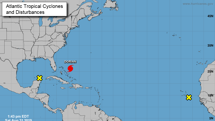
The National Weather Service warned of "life-threatening storm surge and devastating winds" Aug. 31 to the northwestern Bahamas from Hurricane Dorian.
A hurricane warning means that a hurricane is expected to affect the area, while a watch means a hurricane could possibly affect the area.
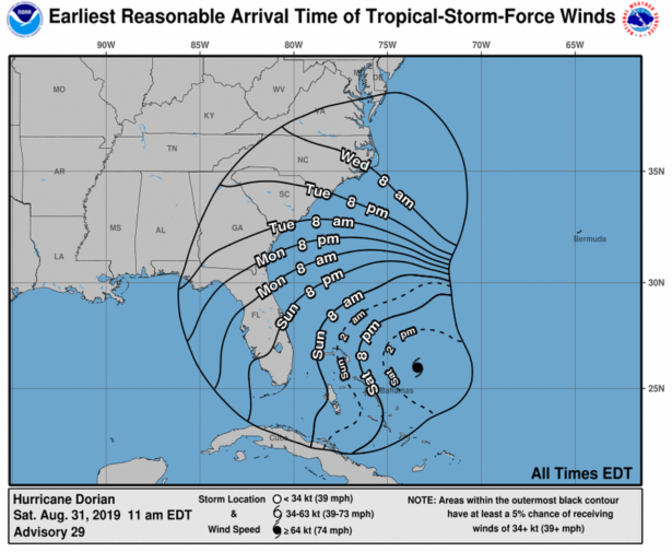
Over two or three days, the hurricane could dump as much as 4 feet of rain and unleash high winds, according to private meteorologist Ryan Maue and some of the most reliable computer models.
The hurricane has already shut down most major resorts in the Bahamas and forced authorities to evacuate much of the northern shore and low-lying islands.
Any remaining tourists were sent to government shelters in schools, churches, and other buildings offering protection from the storm.
“My home is all battened up, and I’m preparing right now to leave in a couple of minutes. ... We’re not taking no chances,” said Margaret Bassett, 55, a ferry boat driver for the Deep Water Cay resort who chose to leave her home. “They said evacuate, you have to evacuate. It’s for the best interests of the people.”
Still, a few fishermen planned to ride it out, which could put them in extreme danger.
“Hoping for the best, that the storm passes and everybody is safe until we return home,” fisherman Tyrone Mitchell said. “All the ladies and children evacuated, and we have about six or seven men that [will] ride out the storm.”
The Bahamas on average faces a direct hit from a hurricane every four years. One Category 5 hurricane and seven Category 4 hurricanes have struck the Bahamas since storms were first recorded in 1851.