
A winter storm packing a frosty mix of snow and ice bore down on the Northeast on Friday, disrupting post-holiday weekend airline traffic and prompting officials in New York and New Jersey to issue weather emergency declarations.
The National Weather Service posted ice storm and winter storm warnings throughout New York state and Connecticut, forecasting some of the heaviest snowfall totals—up to a foot in localized areas—for Long Island and the Hudson Valley.
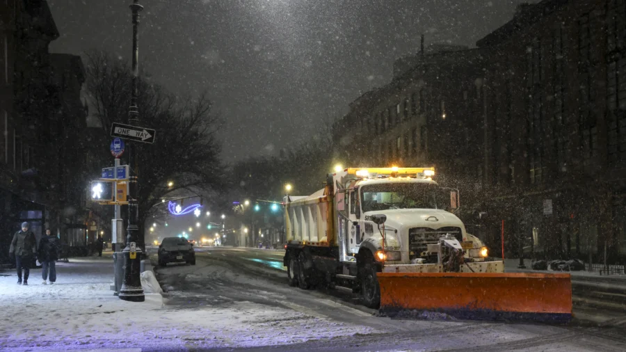
New York City could see its highest accumulations since 2022, with peak snowfall rates of 2 or more inches per hour, according to an emergency declaration on Friday from Gov. Kathy Hochul, warning of treacherous road conditions.
Snow began falling in western New York state and the New York City area on Friday evening and was expected to intensify on Saturday.
In many areas, snow was forecast to be mixed or glazed over with sleet and freezing rain.
Ice storm warnings and winter weather advisories were likewise posted for most of Pennsylvania, much of Massachusetts, and most of New Jersey. High winds were forecast as part of the storm.
More than 1,600 flights were cancelled and nearly 8,300 flights were delayed into and out of the United States on Friday as weather conditions began to worsen, according to the flight-tracking service FlightAware.
New Jersey Acting Gov. Tahesha Way declared a statewide emergency across all 21 counties ahead of the storm.
"Starting this afternoon, we will experience a severe winter storm bringing dangerous outdoor conditions to our state," Way said. "This storm will cause dangerous road conditions and impact holiday travel. We are urging travelers to avoid travel during the storm and allow crews to tend to the roads."
The National Weather Service issued winter storm warnings for 11 counties in New Jersey's northern and central regions: Bergen, Essex, Hudson, Middlesex, Monmouth, Morris, Passaic, Somerset, Sussex, Union, and Warren.
Eight southern counties—Burlington, Camden, Cumberland, Gloucester, Hunterdon, Mercer, Ocean, and Salem—are under winter weather advisories, according to the executive order.
The heaviest snowfall is predicted to begin in the early evening hours on Friday, with accumulations ranging between 4 and 8 inches across central and northern regions. Some higher elevations could see locally higher amounts, while southern portions of the state may receive between 1 and 4 inches.
Morris and Sussex counties face some of the most severe conditions, with snow and sleet accumulations between 5 and 8 inches expected, and local amounts up to 10 inches possible, according to the National Weather Service Mount Holly office. Warren County could see similar totals, with 4 to 7 inches of snow and sleet accumulations plus light ice glazing.
In the storm's most intense phase, precipitation could fall at rates exceeding 1 to 2 inches per hour in northern areas. Sleet and ice may create slippery conditions on snow-covered roadways during heavier precipitation.
Officials warned the rapidly accumulating snow could bring down power lines and trees, resulting in outages that could hamper public and private services. The severe weather may also make it difficult or impossible for residents to obtain essential goods or services, such as police, fire, and first aid.
State transportation crews mobilized ahead of the storm, positioning workers and equipment for quick responses once weather conditions worsen. The Department of Transportation was set to implement a commercial vehicle restriction at 3 p.m. for tractor-trailers, empty commercial driver's license trucks, recreational vehicles, motorcycles, and passenger vehicles pulling trailers on Interstate 78, Interstate 80, Interstate 280, Interstate 287, and Route 440, according to the governor's office.
Way encouraged residents to monitor the state's emergency preparedness website at ready.nj.gov for weather updates and safety information.
Those in northern New Jersey and the New York metro area should check the National Weather Service New York office, while central and southern New Jersey residents should follow updates from the National Weather Service Philadelphia/Mount Holly office.
The emergency declaration grants sweeping powers to state officials to coordinate the response. The state director of emergency management, who serves as the superintendent of State Police, can implement emergency operations plans at the state, county, and municipal levels. Authorities can control traffic flow on any roadway, order evacuations if necessary, and commandeer state facilities to shelter displaced residents.