
With the storm gaining strength on the way to the Florida Panhandle, many schools in the area are closed Monday to brace for its impact.
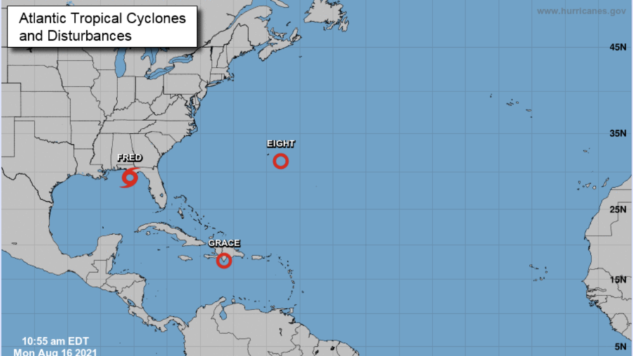
Still about 80 miles south of Apalachicola, Florida, as of Monday morning, Tropical Storm Fred maintained maximum sustained winds of 60 mph while moving toward the state at 10 mph, with an expected landfall in the western Panhandle Monday afternoon or early evening, according to the National Hurricane Center.
Fred had been downgraded but regained its tropical storm status Sunday morning over the Gulf of Mexico, and is forecast to gradually increase in strength as it tracks through the warm waters of the gulf Monday.
The storm is expected to bring dangerous storm surge, river flooding and possible tornadoes when it reaches the US coast, and will then begin to quickly weaken after landfall, according to the NHC.
Tropical Depression Eight is moving south at 8 mph with maximum sustained winds at 35 mph and is forecast to possibly reach tropical storm strength.
A Tropical Storm Warning for Fred is in effect for the coast of the Florida Panhandle from Navarre to the Wakulla-Jefferson County line.
Schools in Bay County, Okaloosa County, Walton County, and Santa Rosa County announced all classes were canceled Monday, as were after school activities.
Classes are expected to resume Tuesday, according to posts on each school district's website.
The storm is expected to bring isolated maximum rainfall totals of 12 inches to the Florida Big Bend and Panhandle through Tuesday, according to the NHC. And heavy rainfall can be expected through parts of southeast Alabama, portions of Georgia and the western Carolinas.
Storm surge is forecast to be highest from Indian Pass to the Steinhatchee River in Florida where a surge of 3 to 5 feet is possible. A storm surge of 1 to 3 feet is forecast Monday from the Alabama-Florida border to Indian Pass, including Pensacola Bay, Choctawhatchee Bay and Saint Andrew Bay.
"As Tropical Storm Fred approaches landfall on the FL Panhandle coastline, the threat for a few tornadoes will increase with supercells moving inland in northeastern and eastern sectors of the circulation," the Storm Prediction Center said.

Tropical Depression Grace Takes Aim at Still Recovering Haiti
Meanwhile, Tropical Depression Grace is tracking through the Caribbean toward Haiti, potentially affecting recovery efforts following a major 7.2-magnitude earthquake that struck Saturday.Grace weakened from a storm to a tropical depression Sunday, with maximum sustained winds of 35 mph.
A tropical storm watch is in effect for the entire coast of Haiti and the entire coast of the Dominican Republic in advance of Grace, which was located 125 miles south southeast of Port-au-Prince, Haiti, Monday morning.
The center of the storm may pass just south or directly over where the earthquake struck Haiti. Either way, there will be impacts that can hamper aid and rescue efforts. Gusty winds and heavy rain are the main threats associated with this storm for Haiti.
Grace is forecast to bring flooding rainfall amounts to Haiti and the Dominican Republic. Widespread rainfall of 5 to 10 inches is forecast, with isolated amounts of up to 15 inches that could also lead to flash flooding and mudslides on Monday and Tuesday.