A
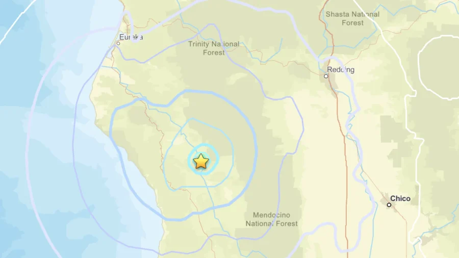
magnitude 4.4 earthquake shook a small town in Northern California on Wednesday afternoon, one minute after a
magnitude 3.9 earthquake struck near the same location, according to the U.S. Geological Survey (USGS).
This comes after a
magnitude 4.0 earthquake struck the same area on Tuesday evening.
The stronger earthquake hit at 3:21 p.m. PT and was centered about 19 miles northwest of Covelo, a community in northern Mendocino County. The quake originated about 2.5 miles below the surface, according to the USGS event record.
The USGS initially estimated its magnitude at 4.5 before a seismologist reviewed the data and revised it to 4.4, as earthquake measurements can change as scientists analyze the data.
About one minute before the stronger earthquake, a magnitude 4.0 earthquake struck the same area at 3:20 p.m. That quake was centered about 19 miles north-northwest of Covelo and had a depth of roughly 4.8 miles, according to a separate USGS event record. Its preliminary magnitude was reported as 4.1 before being revised to 3.9.
Over 100 people
submitted reports indicating that they felt the stronger earthquake as of Wednesday evening, according to data submitted to the USGS “Did You Feel It?” system. There have been no reports of damage or injuries as of Wednesday evening.
Wednesday’s earthquakes were centered about 19 miles northwest of Covelo and about 210 miles north of San Francisco, according to the USGS and
NBC Bay Area. The events occurred in the same general area as another earthquake that took place the day before near Island Mountain in Trinity County.
The earthquakes also struck as Covelo residents dealt with a separate emergency: the 205-acre
Anderson Fire south of town. The wildfire prompted an evacuation warning Wednesday and temporarily closed part of State Route 162 before crews stopped the fire shortly before 4 p.m. Officials lifted the evacuation warning at 4:49 p.m.
"Thank you to our firefighters and cooperating agencies for their quick response and coordinated efforts,"
said California Fire Mendocino Unit on Aug. 5. Wednesday's wildfire was contained at 205 acres, with aerial photos showing structures within the burned area.
On Tuesday, Aug. 4, a separate tremor also occurred in the same area. The USGS recorded that earthquake at magnitude 4.2 after initially estimating it at 4.0. It struck at 5:25 p.m. on Tuesday and originated about 4.7 miles underground, according to the USGS.
The latest earthquakes also come about six weeks after a magnitude 5.6 earthquake struck near Willits in Mendocino County on June 24.
"Some injuries have been reported, but no deaths," Mendocino County officials
said of the June 24 earthquake. It left power outages for over 6,000 residents in Willits, Laytonville, Leggett, Round Valley, and Covelo. It caused minor damage but no widespread structural destruction or deaths, according to Mendocino County officials.