
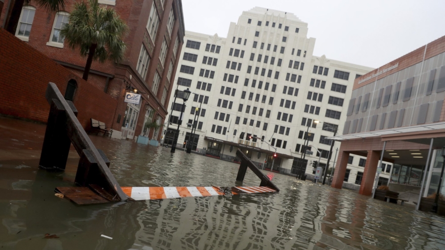
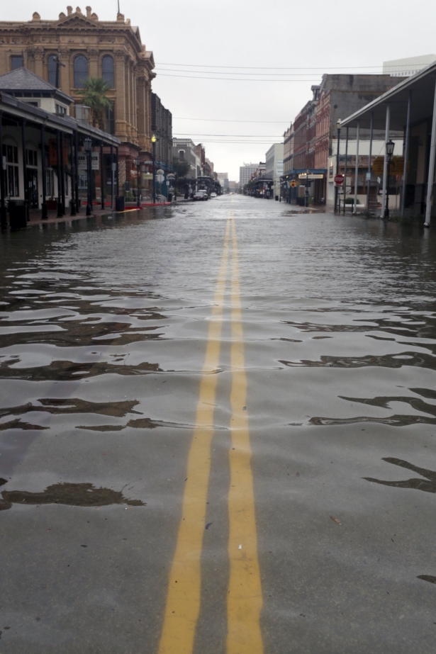
HOUSTON—Tropical Storm Beta stalled out Tuesday along the Texas coast, flooding streets in Houston and Galveston hours after making landfall amid an unusually busy hurricane season.
The storm made landfall late Monday just north of Port O’Connor, Texas, and has the distinction of being the first time a storm named for a Greek letter made landfall in the continental United States. Forecasters ran out of traditional storm names last week, forcing the use of the Greek alphabet for only the second time since the 1950s.
Early Tuesday, Beta was 10 miles east-southeast of Victoria, Texas, with maximum winds of 40 mph, the U.S. National Hurricane Center said. The storm was moving toward the northwest near 3 mph and is expected to stall inland over Texas through Wednesday.
“We currently have both storm surge and rainfall going on right now,” said National Weather Service meteorologist Amaryllis Cotto in Galveston, Texas.
Cotto said 6-12 inches of rain has fallen in the area, with isolated amounts of up to 18 inches. Dangerous flash flooding is expected through Wednesday, Cotto said.
Beta was the ninth named storm that made landfall in the continental U.S. this year. That tied a record set in 1916, according to Colorado State University hurricane researcher Phil Klotzbach.
Beta was forecast to eventually move over Louisiana and Mississippi on Wednesday night through Friday, and the biggest unknown was how much rainfall it could produce. Beta was expected to weaken into a depression, but flash flooding was possible in Arkansas, Louisiana and Mississippi as the system moves farther inland.
Earlier predictions of up to 20 inches in some areas were downgraded Monday to up to 15 inches.
Forecasters and officials reassured residents Beta was not expected to be another Hurricane Harvey or Tropical Storm Imelda. Harvey in 2017 dumped more than 50 inches of rain on Houston, causing $125 billion in damage in Texas. Imelda, which hit Southeast Texas last year, was one of the wettest cyclones on record.
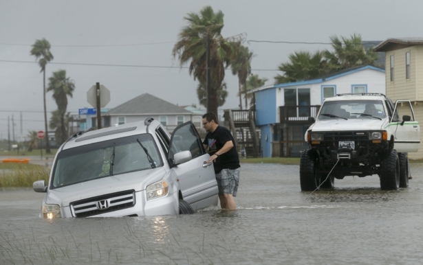
Storm surge up to 4 feet was possible in the Galveston and Beaumont areas through Wednesday morning, forecasters said. In Galveston, an island city southeast of Houston, there was already some street flooding Monday from rising tides and part of a popular fishing pier collapsed due to strong waves.
Farther south on the Texas coast, Maria Serrano Culpepper along with her two daughters and dogs left their home in Magnolia Beach near Matagorda Bay on Sunday night.
Culpepper said she didn’t want to be trapped in her home, three blocks from the beach, with wind, rain and possibly no electricity. She and her family evacuated to a friend’s home in nearby Victoria.
Culpepper said her home should be fine as it’s on stilts 13 feet off the ground and was built to withstand strong storms.
“I’m feeling OK now. I had two nights without sleeping because I was worried about (Beta) being a Category 1 hurricane. I calmed down when the storm lost power,” said Culpepper, who works as an engineer at a nearby chemical plant.
On Monday, Gov. Greg Abbott issued a disaster declaration for 29 Texas counties ahead of Beta’s arrival.
Beta is forecast to dump heavy rain on the southwestern corner of Louisiana three weeks after the same area got pounded by Hurricane Laura. The rainfall and storm surge prompted Louisiana Gov. John Bel Edwards to declare a state of emergency.
In Lake Charles, Mayor Nic Hunter worried about Beta’s rainfall could set back efforts in his Louisiana community to recover after Laura, which damaged about 95% of the city’s 30,000 structures. Hunter said the worry of another storm was “an emotional and mental toll for a lot of our citizens.”
Parts of the Alabama coast and Florida Panhandle were still reeling from Hurricane Sally, which roared ashore Wednesday, causing at least two deaths.
Meanwhile, Hurricane Teddy continued its path toward Canada, with a predicted landfall in Nova Scotia early Wednesday before moving into Newfoundland on Wednesday night, forecasters said. The large and powerful storm was causing dangerous rip currents along the U.S. East Coast, and tropical storm conditions were expected to begin in Nova Scotia by Tuesday afternoon, the National Hurricane Center said.
Teddy was about 365 miles south of Halifax, Nova Scotia, early Tuesday with maximum sustained winds of 105 mph. Teddy was expected to weaken later Tuesday and Wednesday but forecasters said it would likely be a strong, post-tropical cyclone when it moves in and over Nova Scotia.